J4499 : Millbay pier, Millbay, Islandmagee (May 2017)
taken 7 years ago, near to Magheramorne, Co Antrim, Northern Ireland
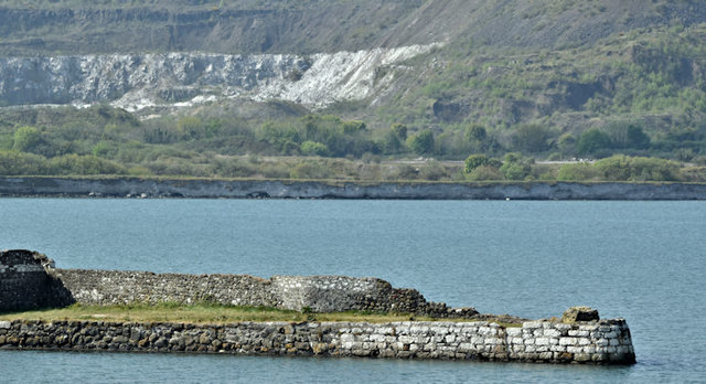
Millbay pier, Millbay, Islandmagee (May 2017)
The disused limestone pier at Millbay seen from the Millbay Road J4499 : The Millbay Road, Millbay, Islandmagee (May 2017). Save for the old boats it looks very similar to this view in May 1989 J4499 : Millbay pier, Islandmagee.
![Creative Commons Licence [Some Rights Reserved]](https://s1.geograph.org.uk/img/somerights20.gif)
|
· Find out How to reuse this image ·
Share:
|
|||||
| Start a discussion on J4499 | Suggest an update to this image | Contact the contributor | |||
Loading map... (JavaScript required)
- Grid Square
- J4499, 14 images (more nearby
 )
)
- Photographer
- Albert Bridge (find more nearby)
- Date Taken
- Wednesday, 10 May, 2017 (more nearby)
- Submitted
- Wednesday, 10 May, 2017
- Geographical Context
- Primary Subject of Photo
- Subject Location
-
Irish:
 J 445 996 [100m precision]
WGS84: 54:49.4126N 5:45.1390W - Camera Location
-
Irish: J 446 998
- View Direction
- South-southwest (about 202 degrees)
Other Tags
This page has been viewed about 144 times.
View this location:
KML (Google Earth) ·
Google Maps ·
Bing Maps ·
Geograph Coverage Map ·
More Links for this image
·
Bing Maps ·
Geograph Coverage Map ·
More Links for this image