S7037 : Summit Cairn
taken 7 years ago, 3 km from Saint Mullin's, Co Carlow, Ireland
This is 1 of 2 images, with title Summit Cairn in this square
Summit Cairn
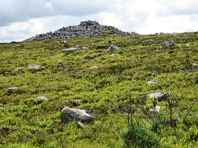
Summit cairn on Cullintra (Cullentragh) Hill (1008ft.) considered to be a Bronze Age burial mound.
![Creative Commons Licence [Some Rights Reserved]](https://s1.geograph.org.uk/img/somerights20.gif)
|
· Find out How to reuse this image ·
Share:
|
|||||
| Start a discussion on S7037 | Suggest an update to this image | Contact the contributor | |||
Loading map... (JavaScript required)
- Grid Square
- S7037, 10 images (more nearby
 )
)
- Photographer
- kevin higgins (find more nearby)
- Date Taken
- Wednesday, 17 May, 2017 (more nearby)
- Submitted
- Wednesday, 17 May, 2017
- Geographical Context
- Subject Location
-
Irish:
 S 701 374 [100m precision]
WGS84: 52:29.0744N 6:58.1321W - Camera Location
-
Irish: S 701 375
- View Direction
- Southwest (about 225 degrees)
This page has been viewed about 39 times.
View this location:
KML (Google Earth) ·
Google Maps ·
Bing Maps ·
Geograph Coverage Map ·
More Links for this image
·
Bing Maps ·
Geograph Coverage Map ·
More Links for this image