J3475 : Former "Rotterdam Bar", Belfast (July 2017)
taken 7 years ago, near to Belfast, Co Antrim, Northern Ireland
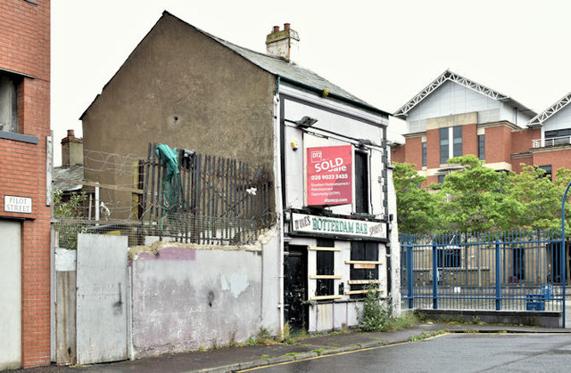
Former "Rotterdam Bar", Belfast (July 2017)
With a sold sign and still standing but a bit more forlorn than in this view J3475 : The Rotterdam Bar, Belfast (May 2009).
Pilot Street and the Olympic Tower, Belfast
There is planning permission (Z/2010/0598/F 31 August 2011) at 54 Pilot Street and 19-22 Princes Dock Street, Belfast for 2 No replacement restaurant/bars and 124 no apartments. All photographs submitted by me appear as a matter of geographical and historical record only. I have no connection with any of the parties involved in the proposed development.
![Creative Commons Licence [Some Rights Reserved]](https://s1.geograph.org.uk/img/somerights20.gif)
|
· Find out How to reuse this image ·
Share:
|
|||||
| Start a discussion on J3475 | Suggest an update to this image | Contact the contributor | |||
Loading map... (JavaScript required)
- Grid Square
- J3475, 773 images (more nearby
 )
)
- Photographer
- Albert Bridge (find more nearby)
- Date Taken
- Saturday, 1 July, 2017 (more nearby)
- Submitted
- Saturday, 1 July, 2017
- Geographical Context
- Place (from Tags)
- Subject Location
-
Irish:
 J 345 752 [100m precision]
WGS84: 54:36.4257N 5:55.1059W - Camera Location
-
Irish: J 345 752
- View Direction
- East-southeast (about 112 degrees)
Other Tags
This page has been viewed about 89 times.
View this location:
KML (Google Earth) ·
Google Maps ·
Bing Maps ·
Geograph Coverage Map ·
More Links for this image
·
Bing Maps ·
Geograph Coverage Map ·
More Links for this image