2017
SO7205 : Path to the Severn shore
taken 7 years ago, 3 km from Moorend, Gloucestershire, England
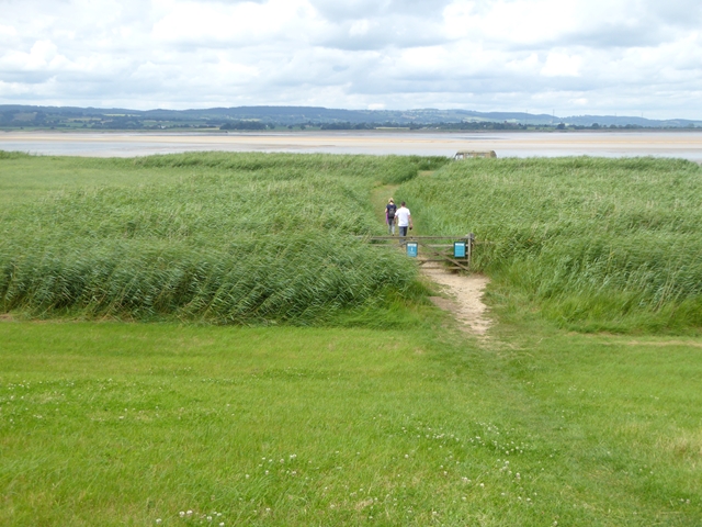
Path to the Severn shore
Path leading to SO7205 : A most unusual bird hide on the Severn salt marshes, part of WWT Slimbridge. The hills of the Forest of Dean can be seen on the far shore.
 Map © Crown Copyright")
TIP: Click the map for more Large scale mapping
- Grid Square
- SO7205, 24 images (more nearby 🔍)
- Photographer
- Oliver Dixon (more nearby)
- Date Taken
- Tuesday, 4 July, 2017 (more nearby)
- Submitted
- Thursday, 6 July, 2017
- Subject Location
-
OSGB36:
 SO 7202 0562 [10m precision]
WGS84: 51:44.9143N 2:24.4017W - Camera Location
-
OSGB36: SO 72052 05579
- View Direction
- Northwest (about 315 degrees)