2017
SH6163 : Quarry development
taken 7 years ago, near to Mynydd Llandygái, Gwynedd, Wales
This is 1 of 2 images, with title starting with Quarry in this square
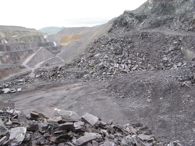
Quarry development
Assuming trustworthy GPS location, the extension of the quarry beyond its mapped limits is easily determined. Here is a view from the Holywell Level down to the next, which is being extended by drilling and blasting. The pile of debris in the foreground is part of the temporary protective bund which is designed to restrain people and vehicles from going over the edge.
 Map © Crown Copyright")
TIP: Click the map for more Large scale mapping
- Grid Square
- SH6163, 22 images (more nearby 🔍)
- Photographer
- Jonathan Wilkins (more nearby)
- Date Taken
- Saturday, 15 July, 2017 (more nearby)
- Submitted
- Tuesday, 18 July, 2017
- Subject Location
-
OSGB36:
 SH 6132 6389 [10m precision]
WGS84: 53:9.2420N 4:4.5213W - Camera Location
-
OSGB36: SH 6118 6379
- View Direction
- Northeast (about 45 degrees)