J3088 : The Hillhead Road, Coleman's Corner near Ballyclare (July 2017)
taken 7 years ago, 3 km from Ballyclare, Co Antrim, Northern Ireland
The Hillhead Road, Coleman's Corner near Ballyclare (July 2017)
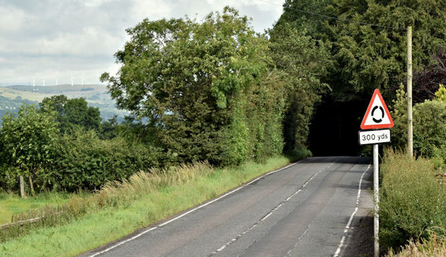
The Hillhead Road J2989 : Lay-by, Ballyclare (May 2017), though classified as a B road, is part of the main road from Ballyclare to Belfast. This view is towards Ballyclare as it approaches the roundabout at Colemans Corner J3088 : The Larne line at Coleman's Corner. The sign (middle right) has been turned by person or persons unknown.
![Creative Commons Licence [Some Rights Reserved]](https://s1.geograph.org.uk/img/somerights20.gif)
|
· Find out How to reuse this image ·
Share:
|
|||||
| Start a discussion on J3088 | Suggest an update to this image | Contact the contributor | |||
Loading map... (JavaScript required)
- Grid Square
- J3088, 6 images (more nearby
 )
)
- Photographer
- Albert Bridge (find more nearby)
- Date Taken
- Saturday, 22 July, 2017 (more nearby)
- Submitted
- Saturday, 22 July, 2017
- Geographical Context
- Place (from Tags)
- Primary Subject of Photo
- Subject Location
-
Irish:
 J 307 884 [100m precision]
WGS84: 54:43.6121N 5:58.2958W - Camera Location
-
Irish: J 307 883
- View Direction
- Northwest (about 315 degrees)
Other Tags
This page has been viewed about 69 times.
View this location:
KML (Google Earth) ·
Google Maps ·
Bing Maps ·
Geograph Coverage Map ·
More Links for this image
·
Bing Maps ·
Geograph Coverage Map ·
More Links for this image