2017
NZ1465 : Diverted course of the Keelman's Way
taken 7 years ago, near to Ryton, Gateshead, England
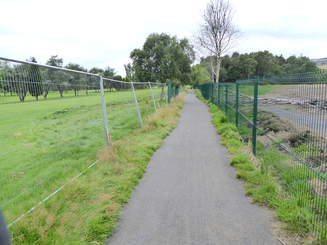
Diverted course of the Keelman's Way
The Keelman's Way path along the south bank of the Tyne has been diverted away from the river bank on account of an underground fire (see NZ1465 : Still smouldering). The path has now been upgraded to tarmac and the affected area fenced off (compare with NZ1465 : Diversion of Keelmans Way); with a rather less substantial fence dividing the path from the golf course.
 Map © Crown Copyright")
TIP: Click the map for more Large scale mapping
- Grid Square
- NZ1465, 82 images (more nearby 🔍)
- Photographer
- Oliver Dixon (more nearby)
- Date Taken
- Monday, 24 July, 2017 (more nearby)
- Submitted
- Tuesday, 25 July, 2017
- Subject Location
-
OSGB36:
 NZ 1407 6534 [10m precision]
WGS84: 54:58.9479N 1:46.9009W - Camera Location
-
OSGB36: NZ 14110 65331
- View Direction
- West-northwest (about 292 degrees)