SK5737 : River Trent
taken 7 years ago, near to West Bridgford, Nottinghamshire, England
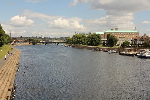
The River Trent is the third longest river in England (185 miles). It rises on Biddolph Moor, Staffordshire, then follows a generally north east to northerly path to join the River Ouse at Trent Falls. The Ouse & Trent combined form the Humber Estuary.
It is a very important river, economically having a number of Power Stations and industrial sites along its banks. It is navigable as far as Burton-On-Trent.
Wikipedia: Link
This was built in 1908 by Nottingham Corporation Water Department in the first instance to carry a water pipeline across the River Trent to Wilford Hill Reservoir, but the opportunity was taken to incorporate a pedestrian facility as well. The bridge still belongs to the water authority (in 2010 Severn Trent Water), and use by pedestrians and cyclists is still only permissive; it is not a right of way. It is Listed Grade II.
The following link shows the bridge during its period of closure and repair between 2008 and 2010, a project which cost £1.9m. Link
 Map © Crown Copyright")
- Grid Square
- SK5737, 332 images (more nearby 🔍)
- Photographer
- Richard Croft (more nearby)
- Date Taken
- Tuesday, 1 August, 2017 (more nearby)
- Submitted
- Saturday, 5 August, 2017
- Subject Location
-
OSGB36:
 SK 5798 3779 [10m precision]
WGS84: 52:56.0633N 1:8.3292W - Camera Location
-
OSGB36: SK 5794 3766
- View Direction
- North-northeast (about 22 degrees)