X2079 : Slipway down to Ballyquin Strand
taken 7 years ago, 3 km from Ardmore, Co Waterford, Ireland
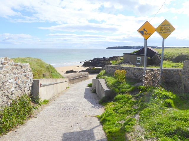
Slipway down to Ballyquin Strand
The village of Ardmore can be seen on the far side of the bay.
![Creative Commons Licence [Some Rights Reserved]](https://s1.geograph.org.uk/img/somerights20.gif)
|
· Find out How to reuse this image ·
Share:
|
|||||
| Start a discussion on X2079 | Suggest an update to this image | Contact the contributor | |||
Loading map... (JavaScript required)
- Grid Square
- X2079, 4 images (more nearby
 )
)
- Photographer
- Oliver Dixon (find more nearby)
- Date Taken
- Friday, 15 September, 2017 (more nearby)
- Submitted
- Monday, 18 September, 2017
- Geographical Context
- Primary Subject of Photo
- Subject Location
-
Irish:
 X 204 798 [100m precision]
WGS84: 51:58.2637N 7:42.1810W - Camera Location
-
Irish: X 204 799
- View Direction
- Southeast (about 135 degrees)
Other Tags
This page has been viewed about 46 times.
View this location:
KML (Google Earth) ·
Google Maps ·
Bing Maps ·
Geograph Coverage Map ·
More Links for this image
·
Bing Maps ·
Geograph Coverage Map ·
More Links for this image