2017
NZ2362 : Dunston Staithes Upper Gate
taken 7 years ago, near to Dunston, Gateshead, England
This is 1 of 16 images, with title starting with Dunston in this square
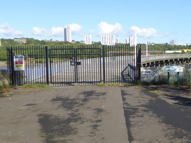
Dunston Staithes Upper Gate
A railway (now converted to a cycle path) used to run through this gate. The apartment blocks are on the far side of the River Tyne.
 Map © Crown Copyright")
TIP: Click the map for more Large scale mapping
- Grid Square
- NZ2362, 219 images (more nearby 🔍)
- Photographer
- Oliver Dixon (more nearby)
- Date Taken
- Tuesday, 19 September, 2017 (more nearby)
- Submitted
- Wednesday, 20 September, 2017
- Subject Location
-
OSGB36:
 NZ 2333 6250 [10m precision]
WGS84: 54:57.3960N 1:38.2334W - Camera Location
-
OSGB36: NZ 23346 62540
- View Direction
- SOUTH (about 180 degrees)