2017
NS3975 : The College Bow in scaffolding
taken 7 years ago, near to Dumbarton, West Dunbartonshire, Scotland
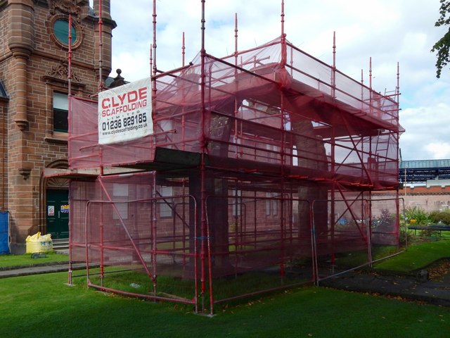
The College Bow in scaffolding
For an equivalent earlier view, see NS3975 : The College Bow.
When the present picture was taken, the Municipal Buildings in the background had themselves only recently been cleared of scaffolding: compare NS3975 : Dumbarton Municipal Buildings (2016) and NS3975 : Dumbarton Municipal Buildings (2017). The College Bow was now receiving attention.
When the present picture was taken, the Municipal Buildings in the background had themselves only recently been cleared of scaffolding: compare NS3975 : Dumbarton Municipal Buildings (2016) and NS3975 : Dumbarton Municipal Buildings (2017). The College Bow was now receiving attention.
The College Bow
This arch, which has been relocated twice in recent centuries, is a remnant of St Mary's Collegiate Church, which was built c.1450. See Link
(at WoSAS) for further details. The College Bow now stands on the eastern side of Dumbarton Municipal Buildings ( Link ). Other, smaller fragments of the Collegiate Church survive: for example, in Glencairn's Greit House ( Link ).
Dumbarton Municipal Buildings
The buildings were erected on College Park (the former grounds of College Park House). The land was bought from the railway company by Lord Overtoun, and gifted by him to the burgh. The buildings, by James Thomson, were officially opened in 1903. The College Bow Link now stands in the grounds, as do a Boer War Memorial Link and a statue of Peter Denny Link
 Map © Crown Copyright")
TIP: Click the map for more Large scale mapping
- Grid Square
- NS3975, 671 images (more nearby 🔍)
- Photographer
- Lairich Rig (more nearby)
- Date Taken
- Saturday, 9 September, 2017 (more nearby)
- Submitted
- Wednesday, 20 September, 2017
- Subject Location
-
OSGB36:
 NS 3978 7551 [10m precision]
WGS84: 55:56.7503N 4:34.0312W - Camera Location
-
OSGB36: NS 3979 7551
- View Direction
- North-northwest (about 337 degrees)