2017
NS4759 : Old quarry
taken 7 years ago, near to Gateside, East Renfrewshire, Scotland
This is 1 of 2 images, with title Old quarry in this square
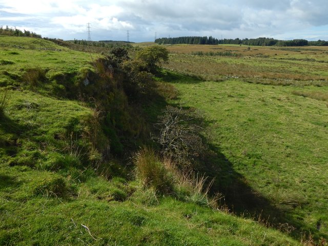
Old quarry
The quarry, whose NNW-facing rock face is about 50 metres long, is labelled "quarry" on the 1895 revision of the 25 inch map, and "old quarry" (meaning "disused") on the 1912 revision. It is in a sloping field, about 160m south of Glenburn Reservoir, and about 245m WNW of the site of a long-gone farm called Duchallaw (see Link for Duchallaw itself).
See other images of Old quarry near Glenburn Reservoir
See other images of Old quarry near Glenburn Reservoir
 Map © Crown Copyright")
TIP: Click the map for more Large scale mapping
- Grid Square
- NS4759, 51 images (more nearby 🔍)
- Photographer
- Lairich Rig (more nearby)
- Date Taken
- Thursday, 14 September, 2017 (more nearby)
- Submitted
- Saturday, 23 September, 2017
- Subject Location
-
OSGB36:
 NS 4767 5976 [10m precision]
WGS84: 55:48.4213N 4:25.9270W - Camera Location
-
OSGB36: NS 4770 5977
- View Direction
- West-southwest (about 247 degrees)