NS4759 : Slope north of a summit cairn
taken 7 years ago, near to Gateside, East Renfrewshire, Scotland
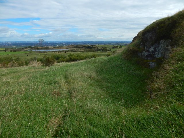
Small-scale quarrying seems to have been carried out at several places near the summit, as here (on the N site); the December 1964 comments at the Canmore link in the end-note state that the summit is bounded "along the E side by old quarrying, and mutilated at the N end by surface quarrying". See NS4759 : Slope east of a summit cairn for the eastern side.
The hill, crowned with a modern marker cairn, gives good views in many directions. It is not named on OS maps, but it may once have been known as Duchal Law, given that an old farmstead just to the north of the hill was called Duchallaw; of that farm, only indistinct footings remain see Link for pictures and for more information.
The summit and its surroundings are described at Link(at Canmore). The first report there, from 1963, describes various old enclosures on the hill; however, according to comments from 1964 and later, those supposed antiquities were a misinterpretation of more recent features.
The reports also mention, but do not name, a "ruined farm" to the north of the hill; it is the aforementioned Duchallaw.
Another modern marker cairn can be seen on Killoch Hill, 830m to the south: NS4758 : Cairn on Killoch Hill.
Remains of a small, older cairn lie within a plantation about 200m NE of the Killoch Hill cairn one: see Link
The author of the Old Statistical Account (1792) for the Parish of Neilston relates (original spelling and punctuation retained) that "there are two tumuli, vulgarly called, cairns, on the top of the Faraneze hills, one of them in particular is of considerable bulk, and there is the foundation of a large dyke, or wall around it, still discernable. A great quantity of stones have been led away from it, but nothing except a few small bones, whether human or not was uncertain, have yet been discovered. Tradition reports that a battle was fought there."
It is not clear where these ancient cairns were located, or whether they correspond to the site of any of the more modern cairns mentioned above. On the name Fereneze itself, see NS4959 : The Fereneze Hills.
 Map © Crown Copyright")
- Grid Square
- NS4759, 51 images (more nearby 🔍)
- Photographer
- Lairich Rig (more nearby)
- Date Taken
- Thursday, 14 September, 2017 (more nearby)
- Submitted
- Sunday, 24 September, 2017
- Subject Location
-
OSGB36:
 NS 4779 5948 [10m precision]
WGS84: 55:48.2728N 4:25.8028W - Camera Location
-
OSGB36: NS 4779 5948
- View Direction
- East-northeast (about 67 degrees)