2017
SK1350 : The boil holes at Ilam
taken 7 years ago, near to Ilam, Staffordshire, England
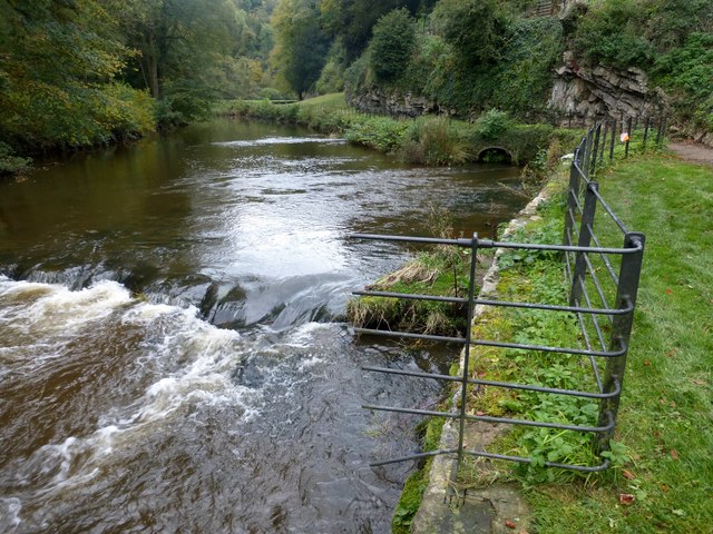
The boil holes at Ilam
The River Manifold in the limestone country north of here is dry for much of the year, having disappeared down sink holes at Wetton Mill. It reappears here in the grounds of Ilam Hall though on this October visit after recent rainfall there was also plenty of water in the surface river.
 Map © Crown Copyright")
TIP: Click the map for more Large scale mapping
- Grid Square
- SK1350, 310 images (more nearby 🔍)
- Photographer
- Graham Hogg (more nearby)
- Date Taken
- Tuesday, 10 October, 2017 (more nearby)
- Submitted
- Wednesday, 11 October, 2017
- Subject Location
-
OSGB36:
 SK 1313 5056 [10m precision]
WGS84: 53:3.1284N 1:48.3344W - Camera Location
-
OSGB36: SK 1316 5056
- View Direction
- WEST (about 270 degrees)