2017
SO8595 : Ebstree Lock west of Lower Penn, Staffordshire
taken 7 years ago, near to Lower Penn, Staffordshire, England
This is 1 of 4 images, with title Ebstree Lock west of Lower Penn, Staffordshire in this square
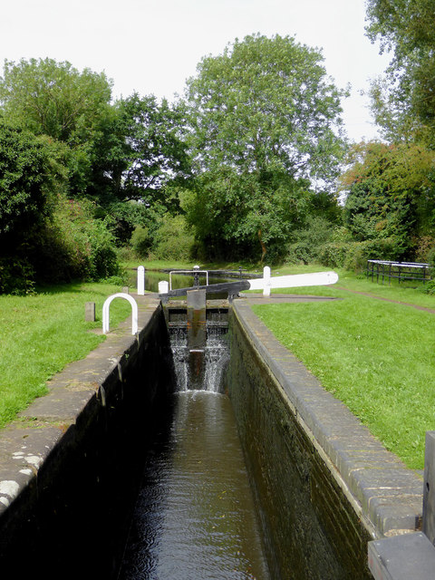
Ebstree Lock west of Lower Penn, Staffordshire
Ebstree Lock on the Staffordshire and Worcestershire Canal provides a rise of nine feet (about 2·7 metres).
 Map © Crown Copyright")
TIP: Click the map for more Large scale mapping
- Grid Square
- SO8595, 203 images (more nearby 🔍)
- Photographer
- Roger D Kidd (more nearby)
- Date Taken
- Friday, 25 August, 2017 (more nearby)
- Submitted
- Wednesday, 11 October, 2017
- Subject Location
-
OSGB36:
 SO 8586 9565 [10m precision]
WGS84: 52:33.5100N 2:12.6001W - Camera Location
-
OSGB36: SO 8586 9562
- View Direction
- NORTH (about 0 degrees)