2017
NZ0599 : Cup and ring "Main Rock", Lordenshaw
taken 7 years ago, near to Whitton, Northumberland, England
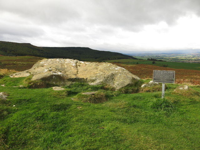
Cup and ring "Main Rock", Lordenshaw
Officially "West Lordenshaw 2c" Archive Link (Archive Link ) panel_detail.asp?pi=541 this is one of the most complex rock art panels in Northumberland, with over a hundred cup and ring motifs reflecting a variety of designs Link . The Stan Beckensall archive of Northumberland Rock Art is at Link (Archive Link ) .
 Map © Crown Copyright")
TIP: Click the map for more Large scale mapping
- Grid Square
- NZ0599, 47 images (more nearby 🔍)
- Photographer
- Mike Quinn (more nearby)
- Date Taken
- Saturday, 7 October, 2017 (more nearby)
- Submitted
- Friday, 13 October, 2017
- Subject Location
-
OSGB36:
 NZ 0522 9914 [10m precision]
WGS84: 55:17.1816N 1:55.1616W - Camera Location
-
OSGB36: NZ 0523 9914
- View Direction
- WEST (about 270 degrees)