2017
NS7357 : Strathclyde Loch and Country Park
taken 7 years ago, near to Motherwell, North Lanarkshire, Scotland
This is 1 of 3 images, with title starting with Strathclyde in this square
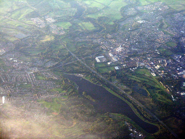
Strathclyde Loch and Country Park
Looking over Hamilton and J6 of the M74 from the north. The River Clyde runs between the loch and the motorway on the right.
 Map © Crown Copyright")
TIP: Click the map for more Large scale mapping
- Grid Square
- NS7357, 23 images (more nearby 🔍)
- Photographer
- M J Richardson (more nearby)
- Date Taken
- Saturday, 30 September, 2017 (more nearby)
- Submitted
- Sunday, 15 October, 2017
- Subject Location
-
OSGB36:
 NS 730 573 [100m precision]
WGS84: 55:47.5356N 4:1.6272W - Camera Location
-
OSGB36: NS 728 629
- View Direction
- SOUTH (about 180 degrees)