2017
SO8697 : Canal east of Castlecroft, Wolverhampton
taken 7 years ago, near to Lower Penn, Staffordshire, England
This is 1 of 3 images, with title Canal east of Castlecroft, Wolverhampton in this square
Canal east of Castlecroft, Wolverhampton
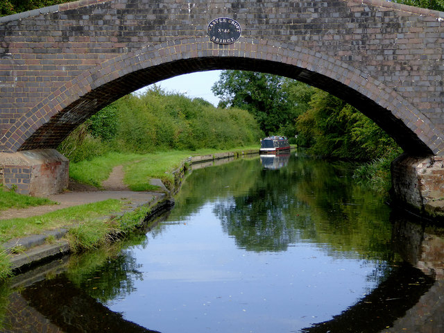
This is the Staffordshire and Worcestershire Canal, looking north-east through the arch of Castlecroft Bridge, No 55. This is an accommodation bridge with no public right of way across it or into adjacent fields.
Accommodation Bridges
When the canals (or railways) were built in the 18th and 19th centuries, they were often routed in such a way that farmers and other landowners had their land bisected, so bridges had to be provided to allow access to fields on both sides of the canal. These bridges are frequently referred to as accommodation bridges, and however solid and well constructed, often don't lead anywhere except from one field to another.
 Map © Crown Copyright")
TIP: Click the map for more Large scale mapping
- Grid Square
- SO8697, 172 images (more nearby 🔍)
- Photographer
- Roger D Kidd (more nearby)
- Date Taken
- Friday, 25 August, 2017 (more nearby)
- Submitted
- Monday, 16 October, 2017
- Subject Location
-
OSGB36:
 SO 8658 9781 [10m precision]
WGS84: 52:34.6762N 2:11.9682W - Camera Location
-
OSGB36: SO 8651 9779
- View Direction
- East-northeast (about 67 degrees)