2017
HP6013 : Burn of Burrafirth
taken 6 years ago, near to Burrafirth, Unst, Shetland Islands, Scotland
This is 1 of 7 images, with title Burn of Burrafirth in this square
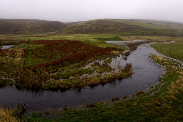
Burn of Burrafirth
Flooding its banks after several recent days of heavy rain.
 Map © Crown Copyright")
TIP: Click the map for more Large scale mapping
- Grid Square
- HP6013, 118 images (more nearby 🔍)
- Photographer
- Mike Pennington (more nearby)
- Date Taken
- Friday, 20 October, 2017 (more nearby)
- Submitted
- Saturday, 21 October, 2017
- Subject Location
-
OSGB36:
 HP 6095 1381 [10m precision]
WGS84: 60:48.1529N 0:52.9125W - Camera Location
-
OSGB36: HP 6097 1378
- View Direction
- North-northwest (about 337 degrees)