2017
TG2503 : View towards Osier Carr
taken 6 years ago, near to Arminghall, Norfolk, England
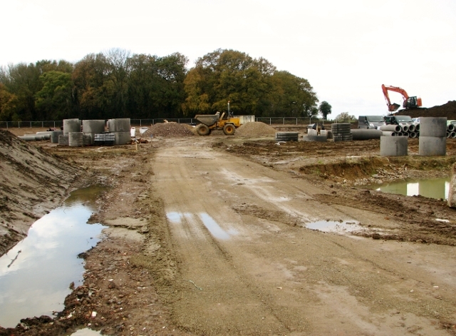
View towards Osier Carr
The track leads into the construction site of a new housing development by Bennett Homes, called "Milestones". The site, which is located in the parish of Bixley and Arminghall, covers the former location of Octagon Farm (the farmhouse was destroyed in a bombing raid on 8/9 May 1942, killing Lilian Mabel Spruce, the farmer's wife) and is spread out over the adjacent former crop fields. Work has recently commenced for the construction of 60 traditionally-built properties.
 Map © Crown Copyright")
TIP: Click the map for more Large scale mapping
- Grid Square
- TG2503, 134 images (more nearby 🔍)
- Photographer
- Evelyn Simak (more nearby)
- Date Taken
- Monday, 13 November, 2017 (more nearby)
- Submitted
- Monday, 13 November, 2017
- Subject Location
-
OSGB36:
 TG 2581 0372 [10m precision]
WGS84: 52:35.0616N 1:19.9079E - Camera Location
-
OSGB36: TG 2589 0376
- View Direction
- West-southwest (about 247 degrees)