H2628 : Derrylin Road
taken 7 years ago, 4 km ESE of Kinawley, Co Fermanagh, Northern Ireland
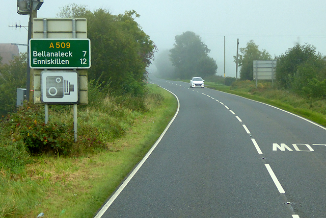
Derrylin Road
The A509 road in Northern Ireland is a single-carriageway primary route which runs for 17 miles through County Fermanagh, from the Irish border to the western outskirts of Enniskillen. The A509 is the continuation of the Irish Primary Route (N3/M3) Link which changes to the A509 when it crosses the border at the George Mitchell Bridge over the Woodford River. It forms part of a road corridor from Dublin to Ballyshannon via the N3 route in the Republic of Ireland and the A4 and A46 routes in Northern Ireland.
See other images of The A509 (Northern Ireland)
See other images of The A509 (Northern Ireland)
![Creative Commons Licence [Some Rights Reserved]](https://s1.geograph.org.uk/img/somerights20.gif)
|
· Find out How to reuse this image ·
Share:
|
|||||
| Start a discussion on H2628 | Suggest an update to this image | Contact the contributor | |||
Loading map... (JavaScript required)
- Grid Square
- H2628, 3 images (more nearby
 )
)
- Photographer
- David Dixon (find more nearby)
- Date Taken
- Monday, 25 September, 2017 (more nearby)
- Submitted
- Sunday, 14 January, 2018
- Geographical Context
- Camera (from Tags)
- Road (from Tags)
- Subject Location
-
Irish:
 H 269 287 [100m precision]
WGS84: 54:12.4316N 7:35.3005W - Camera Location
-
Irish: H 269 287
- View Direction
- North-northwest (about 337 degrees)
Other Tags
This page has been viewed about 75 times.
View this location:
KML (Google Earth) ·
Google Maps ·
Bing Maps ·
Geograph Coverage Map ·
More Links for this image
·
Bing Maps ·
Geograph Coverage Map ·
More Links for this image