H1495 : Stranorlar Presbyterian Church, Letterkenny Road
taken 7 years ago, near to Stranorlar, Co Donegal, Ireland
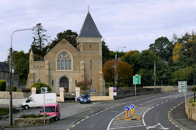
Stranorlar Presbyterian Church, Letterkenny Road
Stranorlar is a small town in the Finn Valley of County Donegal. It is situated at the junction of the N15 and N13 national primary roads. Stranorlar and Ballybofey (located on the other side of the River Finn) form the Twin Towns of Ballybofey-Stranorlar.
The Irish name of Stanorlar is Srath an Urláir, meaning the "valley of the floor" or flat bottomed valley.
The Irish name of Stanorlar is Srath an Urláir, meaning the "valley of the floor" or flat bottomed valley.
![Creative Commons Licence [Some Rights Reserved]](https://s1.geograph.org.uk/img/somerights20.gif)
|
· Find out How to reuse this image ·
Share:
|
|||||
| Start a discussion on H1495 | Suggest an update to this image | Contact the contributor | |||
Loading map... (JavaScript required)
- Grid Square
- H1495, 61 images (more nearby
 )
)
- Photographer
- David Dixon (find more nearby)
- Date Taken
- Monday, 25 September, 2017 (more nearby)
- Submitted
- Sunday, 21 January, 2018
- Geographical Context
- Camera (from Tags)
- Road (from Tags)
- Subject Location
-
Irish:
 H 149 954 [100m precision]
WGS84: 54:48.3954N 7:46.1329W - Camera Location
-
Irish: H 149 954
- View Direction
- North-northwest (about 337 degrees)
Other Tags
This page has been viewed about 92 times.
View this location:
KML (Google Earth) ·
Google Maps ·
Bing Maps ·
Geograph Coverage Map ·
More Links for this image
·
Bing Maps ·
Geograph Coverage Map ·
More Links for this image