J5083 : The 'Seychelles Progress' off Bangor
taken 6 years ago, near to Bangor, Co Down, Northern Ireland
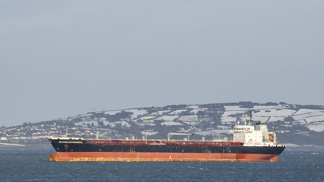
The 'Seychelles Progress' off Bangor
185m (37,557 DWT) Seychelles flagged oil tanker 'Seychelles Progress' Link at anchor off Bangor after discharging in Belfast. A snow covered Muldersleigh Hill J4893 : Muldersleigh Hill near Blackhead near Whitehead is seen across the lough.
![Creative Commons Licence [Some Rights Reserved]](https://s1.geograph.org.uk/img/somerights20.gif)
|
· Find out How to reuse this image ·
Share:
|
|||||
| Start a discussion on J5083 | Suggest an update to this image | Contact the contributor | |||
Loading map... (JavaScript required)
- Grid Square
- J5083, 170 images (more nearby
 )
)
- Photographer
- Rossographer (find more nearby)
- Date Taken
- Wednesday, 17 January, 2018 (more nearby)
- Submitted
- Monday, 22 January, 2018
- Geographical Context
- Place (from Tags)
- Primary Subject of Photo
- Subject Location
-
Irish:
 J 501 836 [100m precision]
WGS84: 54:40.7345N 5:40.3717W - Camera Location
-
Irish: J 507 822
- View Direction
- North-northwest (about 337 degrees)
Other Tags
Image Type (about):
cross grid
This page has been viewed about 52 times.
View this location:
KML (Google Earth) ·
Google Maps ·
Bing Maps ·
Geograph Coverage Map ·
More Links for this image