J3373 : Linenhall Street, Belfast (1982)
taken 42 years ago, near to Belfast, Co Antrim, Northern Ireland
This is 1 of 6 images, with title starting with Linenhall Street, Belfast in this square
Linenhall Street, Belfast (1982)
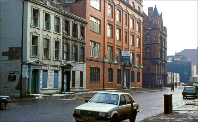
Just about every building in this photo of the eastern side of Linenhall Street, has (long since) been demolished and replaced. The cars too have doubtless vanished into a compactor. For reference, Donegall Square Mews is on the left J3373 : Donegall Square Mews, Belfast. See also J3373 : Linenhall Street, Belfast (2007).
![Creative Commons Licence [Some Rights Reserved]](https://s1.geograph.org.uk/img/somerights20.gif)
|
· Find out How to reuse this image ·
Share:
|
|||||
|
There are 2 posts in a
discussion on J3373 (preview on the left) |
Suggest an update to this image | Contact the contributor | |||
Loading map... (JavaScript required)
- Grid Square
- J3373, 2776 images (more nearby
 )
)
- Photographer
- Albert Bridge (find more nearby)
- Date Taken
- Thursday, 14 January, 1982 (more nearby)
- Submitted
- Wednesday, 3 October, 2007
- Category
- Street (more nearby)
- Subject Location
-
Irish:
 J 33 73 [1000m precision]
WGS84: 54:35.5267N 5:56.1266W - Camera Location
-
Irish: J 33 73
- View Direction
- South-southeast (about 157 degrees)
This page has been viewed about 993 times.
View this location:
KML (Google Earth) ·
Google Maps ·
Bing Maps ·
Geograph Coverage Map ·
More Links for this image
·
Bing Maps ·
Geograph Coverage Map ·
More Links for this image