M1088 : Ireland in Ruins: Raheens House, Co. Mayo (8)
taken 6 years ago, 3 km from Islandeady, Co Mayo, Ireland
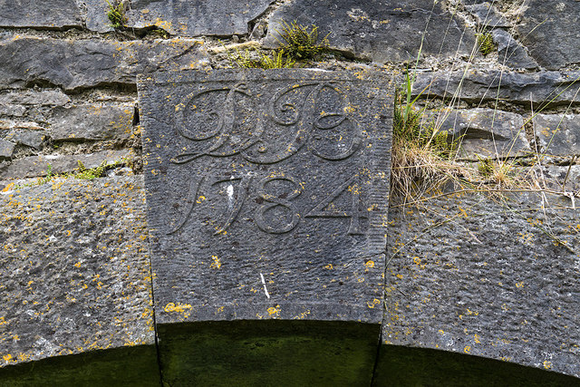
Ireland in Ruins: Raheens House, Co. Mayo (8)
The stable block: cut-limestone keystone with the initials "D B" of Dodwell Browne (d.1796) dated 1784.
M1089 : Ireland in Ruins: Raheens House, Co. Mayo (9)
M1089 : Ireland in Ruins: Raheens House, Co. Mayo (9)
![Creative Commons Licence [Some Rights Reserved]](https://s1.geograph.org.uk/img/somerights20.gif)
|
· Find out How to reuse this image ·
Share:
|
|||||
| Start a discussion on M1088 | Suggest an update to this image | Contact the contributor | |||
Loading map... (JavaScript required)
- Grid Square
- M1088, 10 images (more nearby
 )
)
- Photographer
- Mike Searle (find more nearby)
- Date Taken
- Saturday, 16 June, 2018 (more nearby)
- Submitted
- Tuesday, 3 July, 2018
- Geographical Context
- Subject Location
-
Irish:
 M 1038 8873 [10m precision]
WGS84: 53:50.4271N 9:21.7317W - Camera Location
-
Irish: M 1038 8873
Other Tags
Image Type (about):
close look
This page has been viewed about 83 times.
View this location:
KML (Google Earth) ·
Google Maps ·
Bing Maps ·
Geograph Coverage Map ·
More Links for this image
·
Bing Maps ·
Geograph Coverage Map ·
More Links for this image