2018
NH2953 : Strathconon and the River Meig
taken 6 years ago, near to Milton, Highland, Scotland
This is 1 of 2 images, with title starting with Strath in this square
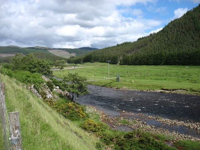
Strathconon and the River Meig
Looking downstream.
Bridges such as the one seen here are usually private, and for the use of landowners, estate workers and fishermen. Public use is often permitted (as in this case), but there are usually signs warning that such use is at the walker's own risk, and no liability is accepted. Fair enough, I think.
The single-track road in Strathconon is just to the left of this picture. I would not want to be forced off it to the right.
 Map © Crown Copyright")
TIP: Click the map for more Large scale mapping
- Grid Square
- NH2953, 41 images (more nearby 🔍)
- Photographer
- David Purchase (more nearby)
- Date Taken
- Friday, 15 June, 2018 (more nearby)
- Submitted
- Sunday, 15 July, 2018
- Subject Location
-
OSGB36:
 NH 2935 5388 [10m precision]
WGS84: 57:32.5649N 4:51.1711W - Camera Location
-
OSGB36: NH 2919 5376
- View Direction
- Northeast (about 45 degrees)