O1642 : Dublin Airport - airside
taken 6 years ago, near to Santry, Dublin, Ireland
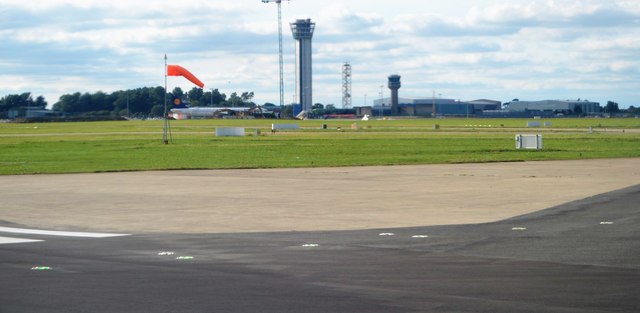
Dublin Airport - airside
Dublin Airport is an international airport. It is operated by DAA (formerly Dublin Airport Authority). The airport is located 10 km north of Dublin in Collinstown, Fingal. In 2017, over 29.5 million passengers passed through the airport, making it the airport's busiest year on record. It is the 14th busiest airport in Europe, and is also the busiest of the state's airports by total passenger traffic. It has the greatest traffic levels on the island of Ireland, followed by Belfast International Airport, County Antrim.
The airport has an extensive short and medium haul network, served by a variety of carriers, as well as a significant long-haul network focused on North America, the Middle East and East Asia.
See other images of Dublin Airport
The airport has an extensive short and medium haul network, served by a variety of carriers, as well as a significant long-haul network focused on North America, the Middle East and East Asia.
See other images of Dublin Airport
![Creative Commons Licence [Some Rights Reserved]](https://s1.geograph.org.uk/img/somerights20.gif)
|
· Find out How to reuse this image ·
Share:
|
|||||
| Start a discussion on O1642 | Suggest an update to this image | Contact the contributor | |||
Loading map... (JavaScript required)
- Grid Square
- O1642, 29 images (more nearby
 )
)
- Photographer
- N Chadwick (find more nearby)
- Date Taken
- Saturday, 4 August, 2018 (more nearby)
- Submitted
- Thursday, 24 January, 2019
- Geographical Context
- Subject Location
-
Irish:
 O 162 426 [100m precision]
WGS84: 53:25.2716N 6:15.1097W - Camera Location
-
Irish: O 163 425
- View Direction
- Northwest (about 315 degrees)
This page has been viewed about 35 times.
View this location:
KML (Google Earth) ·
Google Maps ·
Bing Maps ·
Geograph Coverage Map ·
More Links for this image
·
Bing Maps ·
Geograph Coverage Map ·
More Links for this image