2019
NC8300 : The John O'Groats Trail crossing Golspie Burn
taken 5 years ago, near to Golspie, Highland, Scotland
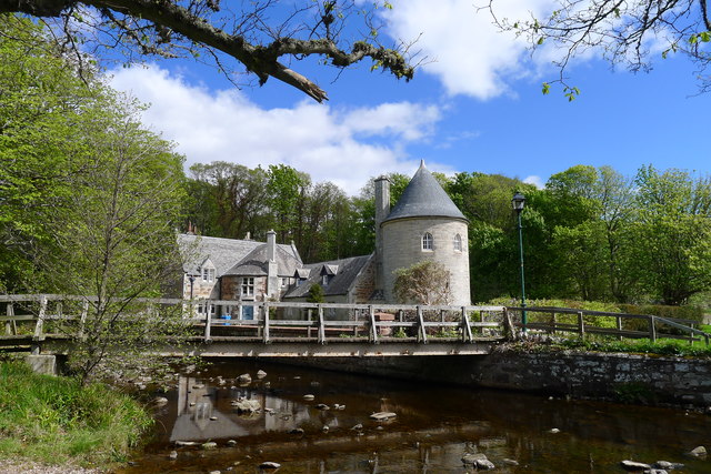
The John O'Groats Trail crossing Golspie Burn
With Dunrobin Castle Tower Lodge (1895) behind
John O'Groats Trail
For detailed information and a route guide to the John O'Groats Trail see Link
. In June 2018 the trail is "a work in progress", with the laudable aim of connecting the West Highland Way and Great Glen Way to the far north of Scotland via a 147 mile walking route from Inverness to John O'Groats. Unfortunately, unless the walker is able to 'wild camp', logistics preclude an inland route through the centre of the magnificent Highlands. Instead, the John O'Groats Trail sticks to the east coast "traversing shorelines, cliff tops, back lanes and footpaths of the Scottish Highlands."
 Map © Crown Copyright")
TIP: Click the map for more Large scale mapping
- Grid Square
- NC8300, 191 images (more nearby 🔍)
- Photographer
- Tim Heaton (more nearby)
- Date Taken
- Sunday, 12 May, 2019 (more nearby)
- Submitted
- Wednesday, 22 May, 2019
- Subject Location
-
OSGB36:
 NC 8396 0019 [10m precision]
WGS84: 57:58.5470N 3:57.8166W - Camera Location
-
OSGB36: NC 8394 0015
- View Direction
- North-northeast (about 22 degrees)