G3237 : Rathlee Signal Tower
taken 20 years ago, near to Rathlee, Co Sligo, Ireland
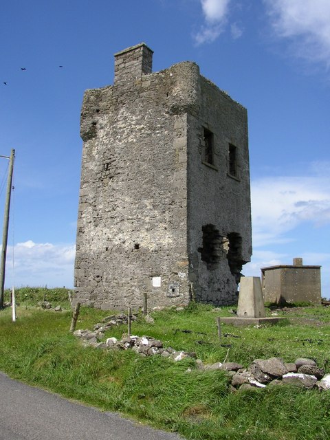
Rathlee Signal Tower
This tower and many others like it around the Irish coast are Napoleonic Signal Towers, part of the coastal defences built by the British after the 1798 Rebellion and the failed French invasion. Inset into the wall of the tower is an old plaque that erroneously describes it as being an O'Dowd castle Link . It's been suggested that the signal tower actually stands on the site of an O'Dowd castle, and maybe that's where the plaque originated from.
![Creative Commons Licence [Some Rights Reserved]](https://s1.geograph.org.uk/img/somerights20.gif)
|
· Find out How to reuse this image ·
Share:
|
|||||
| Start a discussion on G3237 | Suggest an update to this image | Contact the contributor | |||
Loading map... (JavaScript required)
- Grid Square
- G3237, 6 images (more nearby
 )
)
- Photographer
- Paul Burns (find more nearby)
- Date Taken
- Saturday, 29 May, 2004 (more nearby)
- Submitted
- Wednesday, 28 November, 2007
- Category
- Castle > Castle (more nearby)
- Subject Location
-
Irish:
 G 322 373 [100m precision]
WGS84: 54:16.8184N 9:2.4714W - Camera Location
-
Irish: G 322 373
- View Direction
- North-northwest (about 337 degrees)
This page has been viewed about 1031 times.
View this location:
KML (Google Earth) ·
Google Maps ·
Bing Maps ·
Geograph Coverage Map ·
More Links for this image