Q5501 : End of Cyclepath and Walkway
taken 5 years ago, 4 km WSW of Anascaul, Co Kerry, Ireland
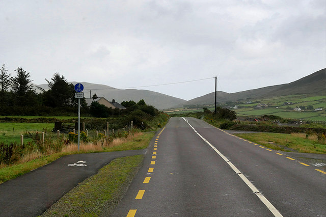
End of Cyclepath and Walkway
The end of the cycleway/footpath next to a recently improved section of the N86.
Irish National Secondary Road N86
The N86 road is a national secondary road in County Kerry. It runs for 50 km from Tralee (Castlemaine Road Roundabout on the N22/N69 Tralee Bypass) to Dingle. It is single carriageway throughout but in recent years, there have been significant improvements to certain stretches of the road.
![Creative Commons Licence [Some Rights Reserved]](https://s1.geograph.org.uk/img/somerights20.gif)
|
· Find out How to reuse this image ·
Share:
|
|||||
| Start a discussion on Q5501 | Suggest an update to this image | Contact the contributor | |||
Loading map... (JavaScript required)
- Grid Square
- Q5501, 3 images (more nearby
 )
)
- Photographer
- David Dixon (find more nearby)
- Date Taken
- Wednesday, 14 August, 2019 (more nearby)
- Submitted
- Monday, 4 November, 2019
- Geographical Context
- Camera (from Tags)
- Road (from Tags)
- Subject Location
-
Irish:
 Q 556 010 [100m precision]
WGS84: 52:8.5478N 10:6.5935W - Camera Location
-
Irish: Q 555 010
- View Direction
- EAST (about 90 degrees)
Other Tags
This page has been viewed about 25 times.
View this location:
KML (Google Earth) ·
Google Maps ·
Bing Maps ·
Geograph Coverage Map ·
More Links for this image
·
Bing Maps ·
Geograph Coverage Map ·
More Links for this image