2003
NH4937 : Trig point of Glaodhaich
taken 21 years ago, 3 km from Camault Muir, Highland, Scotland
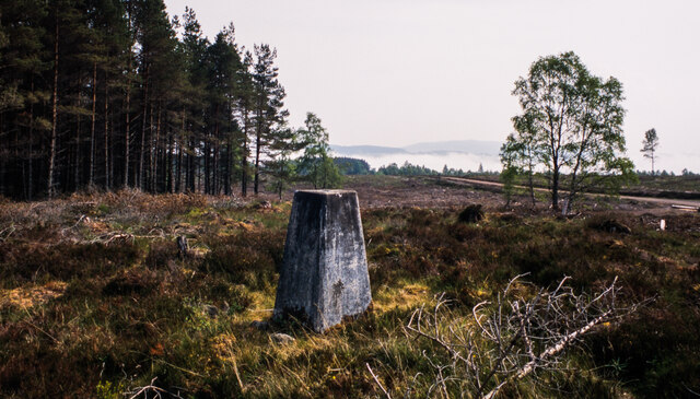
Trig point of Glaodhaich
The triangulation column known to the OS as Glaodhaich with the surrounding coniferous plantations as they were in May 2003.
 Map © Crown Copyright")
TIP: Click the map for more Large scale mapping
- Grid Square
- NH4937, 15 images (more nearby 🔍)
- Photographer
- Trevor Littlewood (more nearby)
- Date Taken
- Saturday, 31 May, 2003 (more nearby)
- Submitted
- Friday, 13 November, 2020
- Subject Location
-
OSGB36:
 NH 4993 3750 [10m precision]
WGS84: 57:24.1831N 4:29.9606W - Camera Location
-
OSGB36: NH 4991 3751
- View Direction
- East-southeast (about 112 degrees)