V7750 : The Mare's Tail Waterfall on Hungry Hill
taken 30 years ago, 4 km W of Adrigole, Co Cork, Ireland
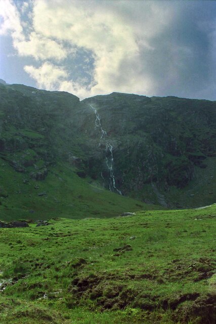
The Mare's Tail Waterfall on Hungry Hill
The Mare's Tail waterfall at the eastern end of Hungry Hill is the highest waterfall in Ireland and the UK.
Camera: Canon AE-1 Program
Film: Kodak Gold 200
Scanned using a CanoScan 9000F Mark II
Processed with Adobe Photoshop Elements 15
Camera: Canon AE-1 Program
Film: Kodak Gold 200
Scanned using a CanoScan 9000F Mark II
Processed with Adobe Photoshop Elements 15
![Creative Commons Licence [Some Rights Reserved]](https://s1.geograph.org.uk/img/somerights20.gif)
|
· Find out How to reuse this image ·
Share:
|
|||||
| Start a discussion on V7750 | Suggest an update to this image | Contact the contributor | |||
Loading map... (JavaScript required)
- Grid Square
- V7750 (more nearby
 )
)
- Photographer
- Jeff Buck (find more nearby)
- Date Taken
- Saturday, 4 June, 1994 (more nearby)
- Submitted
- Tuesday, 9 February, 2021
- Geographical Context
- County (from Tags)
- Country (from Tags)
- Subject Location
-
Irish:
 V 774 502 [100m precision]
WGS84: 51:41.5001N 9:46.4228W - Camera Location
-
Irish: V 779 500
- View Direction
- West-northwest (about 292 degrees)
Other Tags
This page has been viewed about 242 times.
View this location:
KML (Google Earth) ·
Google Maps ·
Bing Maps ·
Geograph Coverage Map ·
More Links for this image
·
Bing Maps ·
Geograph Coverage Map ·
More Links for this image