O1102 : View down the valley from the Glenmacnass Waterfall
taken 30 years ago, 7 km NNW of Laragh, Co Wicklow, Ireland
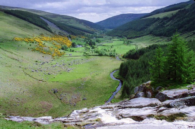
View down the valley from the Glenmacnass Waterfall
View down into the valley from the top of the Glenmacnass
Waterfall.
Wikipedia Link
Camera: Canon AE-1 Program
Film: Kodak Gold 200
Scanned using a CanoScan 9000F Mark II
Processed with Adobe Photoshop Elements 15
Waterfall.
Wikipedia Link
Camera: Canon AE-1 Program
Film: Kodak Gold 200
Scanned using a CanoScan 9000F Mark II
Processed with Adobe Photoshop Elements 15
![Creative Commons Licence [Some Rights Reserved]](https://s1.geograph.org.uk/img/somerights20.gif)
|
· Find out How to reuse this image ·
Share:
|
|||||
| Start a discussion on O1102 | Suggest an update to this image | Contact the contributor | |||
Loading map... (JavaScript required)
- Grid Square
- O1102, 29 images (more nearby
 )
)
- Photographer
- Jeff Buck (find more nearby)
- Date Taken
- Tuesday, 7 June, 1994 (more nearby)
- Submitted
- Thursday, 11 February, 2021
- Geographical Context
- Country (from Tags)
- County (from Tags)
- Place (from Tags)
- Subject Location
-
Irish:
 O 115 026 [100m precision]
WGS84: 53:3.7933N 6:20.1797W - Camera Location
-
Irish: O 115 027
- View Direction
- South-southeast (about 157 degrees)
Other Tags
This page has been viewed about 46 times.
View this location:
KML (Google Earth) ·
Google Maps ·
Bing Maps ·
Geograph Coverage Map ·
More Links for this image