M1677 : Castleburke, Ballintubber
taken 30 years ago, near to Ballintober, Co Mayo, Ireland
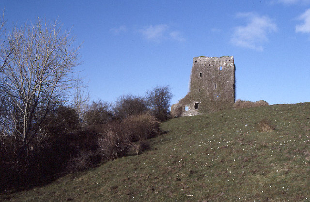
Castleburke, Ballintubber.
This "castle" stands on a bluff overlooking Lough Carra; the redoubt of the Burkes.
![Creative Commons Licence [Some Rights Reserved]](https://s1.geograph.org.uk/img/somerights20.gif)
|
· Find out How to reuse this image ·
Share:
|
|||||
| Start a discussion on M1677 | Suggest an update to this image | Contact the contributor | |||
Loading map... (JavaScript required)
- Grid Square
- M1677, 4 images (more nearby
 )
)
- Photographer
- Dr Charles Nelson (find more nearby)
- Date Taken
- February 1994 (more nearby)
- Submitted
- Tuesday, 25 October, 2005
- Category
- Castle > Castle (more nearby)
- Subject Location
-
Irish:
 M 16 77 [1000m precision]
WGS84: 53:44.4361N 9:15.9725W
This page has been viewed about 354 times.
View this location:
KML (Google Earth) ·
Google Maps ·
Bing Maps ·
Geograph Coverage Map ·
More Links for this image
·
Bing Maps ·
Geograph Coverage Map ·
More Links for this image