O0984 : Ruined farmhouse at Brittas, Co. Louth
taken 16 years ago, near to Grangebellew, Co Louth, Ireland
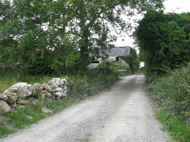
Ruined farmhouse at Brittas, Co. Louth
Buildings shown here on maps of 1778 (Taylor and Skinner) and 1835 (O.S. 1st edition) are in a different arrangement so this now derelict farmhouse is probably mid-19th century. Lane leads to ruins of Drumshallon church.
![Creative Commons Licence [Some Rights Reserved]](https://s1.geograph.org.uk/img/somerights20.gif)
|
· Find out How to reuse this image ·
Share:
|
|||||
| Start a discussion on O0984 | Suggest an update to this image | Contact the contributor | |||
Loading map... (JavaScript required)
- Grid Square
- O0984 (more nearby
 )
)
- Photographer
- Kieran Campbell (find more nearby)
- Date Taken
- Saturday, 12 July, 2008 (more nearby)
- Submitted
- Sunday, 13 July, 2008
- Category
- Farmhouse (ruined) (more nearby)
- Subject Location
-
Irish:
 O 0931 8416 [10m precision]
WGS84: 53:47.7393N 6:20.5150W - Camera Location
-
Irish: O 0932 8413
- View Direction
- North-northwest (about 337 degrees)
This page has been viewed about 195 times.
View this location:
KML (Google Earth) ·
Google Maps ·
Bing Maps ·
Geograph Coverage Map ·
More Links for this image
·
Bing Maps ·
Geograph Coverage Map ·
More Links for this image