2005
SP9325 : Leighton Buzzard: Narrow gauge railway
taken 18 years ago, near to Leighton Buzzard, Central Bedfordshire, England
Leighton Buzzard: Narrow gauge railway
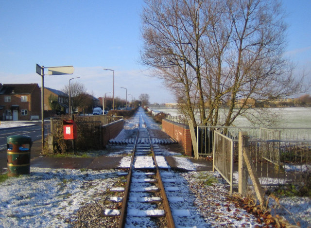
The railway was originally built in 1919 to carry sand from nearby quarries to the now dismantled Leighton Buzzard to Dunstable standard gauge railway line close to Page's Park. It closed as an industrial line in 1969, but was taken over by volunteers to be run as a heritage railway. The railway has a very informative website here Link A light dusting of snow covers the ground in this view, taken looking north westwards where the railway runs parallel to the road called Meadway on the left. The brick walls are the parapets of the railway bridge over Clipstone Brook, a tributary of the River Ouzel.
 Map © Crown Copyright")
TIP: Click the map for more Large scale mapping
- Grid Square
- SP9325, 23 images (more nearby 🔍)
- Photographer
- Nigel Cox (more nearby)
- Date Taken
- Wednesday, 28 December, 2005 (more nearby)
- Submitted
- Thursday, 29 December, 2005
- Subject Location
-
OSGB36:
 SP 933 259 [100m precision]
WGS84: 51:55.4288N 0:38.6798W