|
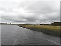
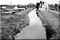
Shannon Navigation Marker, The Callows, Co. Offaly
by JP
geograph for square M9111
The navigation markers on this stretch of the Shannon are green on the east... (more)
|
|
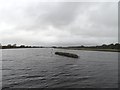
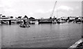
River Shannon North of Portumna Bridge
by JP
geograph for square M8705
The centre of the river is the county border, so to the left is Galway and right... (more)
|
|
Power Lines over the River Shannon, Kilnacrusha, Co. Offaly
by JP
geograph for square M9010
|
|
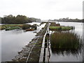
Weir on the Shannon at Meelick, Co. Offaly
by JP
geograph for square M9413
The walkway took a battering in recent heavy rains.
|
|
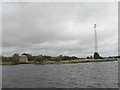
Pumping Station and Pylon, Cappagh, Co. Galway
by JP
geograph for square M8909
|
|
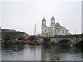
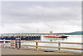
River Shannon, Athlone
by Richard Webb
geograph for square N0441
A boom upstream of a weir.
|
|
River Shannon, Athlone
by Richard Webb
geograph for square N0341
A Viking themed tour boat moves quickly downstream. There was plenty of water... (more)
|
|
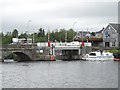
Lifting Bridge on the Shannon in Roosky, Co. Roscommon
by JP
for square N0587
Strictly speaking the lifting part is in Longford as the border runs up the... (more)
|
|
The "Shannon Willow" at Killimer
by Albert Bridge
geograph for square R0652
The estuarial passenger/vehicle ferry Shannon Willow (built in Bowling in... (more)
|
|
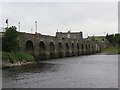
Shannon Bridge built 1757 over the River Shannon
by Martin Dawes
geograph for square M9625
It is also the county boundary. This side is Co Offaly, the other side Co Roscommon.
|
|
Shannon Bridge over River Shannon at Shannonbridge
by Martin Dawes
geograph for square M9625
The bridge was built in 1757. The fortification over the bridge was built in... (more)
|
|
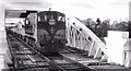
Sugar beet train, Athlone
by Albert Bridge
geograph for square N0341
CIE locomotive no 177 heads a Tuam Navan train of empty beet wagons across the... (more)
|
|
The new Shannon Bridge, Limerick
by Albert Bridge
geograph for square R5756
The new Shannon Bridge under construction, downstream of the Sarsfield Bridge of... (more)
|
|
River Shannon cruise to Clonmacnoise from Shannonbridge
by Martin Dawes
geograph for square M9625
|
|
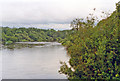
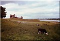
River Shannon at Jamestown, border Cos. Roscommon and Leitrim, 1993
by Ben Brooksbank
geograph for square M9898
View SSE from off N4 at Jamestown.
|
|
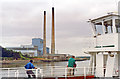
Tarbert power station, from ferry
by Ben Brooksbank
geograph for square R0749
View southward from ferry across River Shannon to Killimer.
|
|
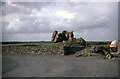
Castle remains - Clonmacnoise, County Offaly
by Martin Richard Phelan
geograph for square N0030
Supposed to have been built by King John in the early 13th century, it may have... (more)
|
|
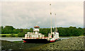
Tarbert: ferry across River Shannon, 1993
by Ben Brooksbank
geograph for square R0749
View north, from Tarbert landing-stage.
|
|
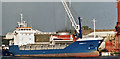
The "Arabella C" at Foynes (July 2002)
by Albert Bridge
for square R2451
The 91 metres/4,216 deadweight tonnes coaster Arabella C... (more)
|
|
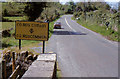
Leitrim/Roscommon county boundary sign
by Albert Bridge
geograph for square M9997
|
|
The Royal canal at Hill of Down
by Albert Bridge
geograph for square N6547
The Royal canal,connecting Dublin to the Shannon, was built between 1790 and... (more)
|
|
Clonmacnoise, Co. Offaly
by nick macneill
geograph for square N0030
|
|
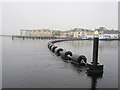
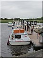
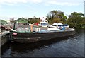
45M Barge at Portumna Bridge, Co. Galway
by JP
geograph for square M8604
As featured in the BBC's "Three Men In A Boat" visit to Ireland... (more)
|