Public Tags
Tag: Tidal·Variation
Showing images tagged with Tidal Variation tag.
|
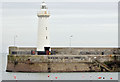
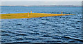
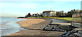
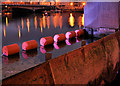
Donaghadee lighthouse (February 2015)
by Albert Bridge geograph for square J5980 Donaghadee lighthouse Link about 50... (more)
Tags:
Commissioners of Irish LightsX
top:Docks, HarboursX
place:DonaghadeeX
Donaghadee HarbourX
HarbourX
LighthouseX
subject:LighthouseX
Tidal Variation
|
|
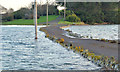
Yacht Club jetty, Holywood
by Albert Bridge geograph for square J3979 14.03 the rising tide had almost covered the yacht clubs jetty. For... (more)
Tags:
top:Air, Sky, WeatherX
top:CoastalX
Flood WarningX
Flooding AlertX
place:HolywoodX
JettyX
Tidal Variation
|
|
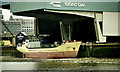
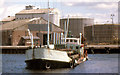
The "Conformity", River Thames, Millwall
by Albert Bridge for square TQ3779 The coaster Conformity, at the London Steel Terminal, on the Thames at... (more)
|
|
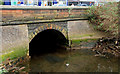
Outfall, Holywood
by Albert Bridge geograph for square J3979 See J3979 : Sunset, Holywood (4). The same outfall (which might be disused) seen by daylight.... (more)
|
|
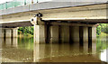
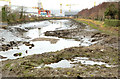
The tidal River Lagan, Stranmillis, Belfast (10 August 2014)
by Albert Bridge for square J3371 The impounded stretch of the River Lagan, as far as the Stranmillis weir... (more)
Tags:
top:Air, Sky, WeatherX
place:BelfastX
BridgeX
PerigeeX
subject:RiverX
RiverX
River LaganX
top:Rivers, Streams, DrainageX
Stranmillis (Belfast)X
Tidal RiverX
Tidal Variation
|
|
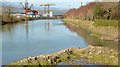
The Connswater, Belfast (11)
by Albert Bridge geograph for square J3674 Category: River The Connswater Bridge, on the Newtownards Road, immediately downstream of the... (more)
|
|
The "Tredagh" at Arklow (1988)
by Albert Bridge geograph for square T2573 Arklow harbour has the disadvantage of having sandy beaches to the north and... (more)
|
|
The Connswater, Belfast (12)
by Albert Bridge geograph for square J3674 Category: River The tidal part of the Connswater, about 40 minutes before high water, seen from... (more)
Tags:
Tidal Variation
|
|
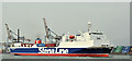
The "Stena Hibernia", Belfast harbour (April 2019)
by Albert Bridge for square J3678 The freight ferry Stena Hibernia departing, at 11.00, with the 09.00 sailing... (more)
Tags:
place:BelfastX
Belfast HarbourX
type:Cross GridX
top:Docks, HarboursX
subject:FerryX
FerryX
StenaX
Stena HiberniaX
Stena LineX
Tidal Variation
|
|
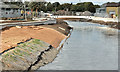
Spring tide, Connswater, Mersey Street, Belfast (December 2018)
by Albert Bridge for square J3674 The view, downstream, at Mersey Street, some 30 minutes after a high tide... (more)
Tags:
place:BelfastX
type:Close LookX
ConnswaterX
Moon PhaseX
RiverX
subject:RiverX
top:Rivers, Streams, DrainageX
Spring TideX
Tidal RiverX
Tidal Variation
Winter SolsticeX
|
|
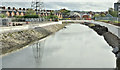
Connswater works, Belfast - September 2016(8)
by Albert Bridge geograph for square J3674 Looking upstream from Mersey Street about 20 minutes after high water. Much of... (more)
Tags:
place:BelfastX
ConnswaterX
subject:ConstructionX
top:Construction, DevelopmentX
Flood Defence WallX
Flood ProtectionX
type:GeographX
RiverX
top:Rivers, Streams, DrainageX
Tidal RiverX
Tidal Variation
|
|
Connswater works, Belfast - September 2016(7)
by Albert Bridge geograph for square J3674 Looking downstream from Mersey Street about 20 minutes after high water. This... (more)
Tags:
place:BelfastX
ConnswaterX
subject:ConstructionX
top:Construction, DevelopmentX
Flood Defence WallX
Flood ProtectionX
type:GeographX
RiverX
top:Rivers, Streams, DrainageX
Tidal RiverX
Tidal Variation
|
|
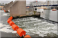
The high River Lagan at the Lagan Weir (January 2016)
by Albert Bridge geograph for square J3474 The Lagan continues to be relatively high J3474 : Debris, River Lagan, Belfast (December 2015) after the recent spell of... (more)
Tags:
top:Air, Sky, WeatherX
place:BelfastX
Lagan Weir (Belfast)X
subject:RiverX
RiverX
River LaganX
top:Rivers, Streams, DrainageX
Tidal RiverX
Tidal Variation
|
|
New Lagan weir footbridge, Belfast - March 2015(11)
by Albert Bridge geograph for square J3474 The Queens Quay side of the Lagan Weir, about 15 minutes before low water,... (more)
|
|
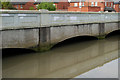
The Connswater, Mersey Street, Belfast (February 2015)
by Albert Bridge for square J3674 The Connswater, at the Mersey Street bridge, about 30 minutes before high water... (more)
Tags:
place:BelfastX
BridgeX
ConnswaterX
High TideX
RiverX
subject:RiverX
top:Rivers, Streams, DrainageX
Tidal RiverX
Tidal Variation
|
|
The Connswater, Belfast (March 2014)
by Albert Bridge geograph for square J3675 The Connswater, looking downstream from the Sydenham bypass, about 20 minutes... (more)
|
|
The Connswater, Belfast - February 2014
by Albert Bridge geograph for square J3675 The Connswater, appearing particularly unpleasant, looking downstream from the... (more)
|
|
The Connswater, Belfast (23)
by Albert Bridge for square J3674 The Connswater, at the Connswater Bridge on the Newtownards Road, a few minutes... (more)
|
|
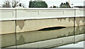
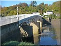
Chepstow Old Bridge
by Robin Drayton geograph for square ST5394 Taken at low tide.
A nearby plaque states:
The Wye bridge in Chepstow spans... (more)
Tags:
place:ChepstowX
top:Rivers, Streams, DrainageX
Road Bridge Over RiverX
top:Roads, Road TransportX
Tidal Variation
river:WyeX
|
|
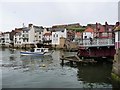
Boat passing through open swingbridge, Whitby
by Christine Johnstone geograph for square NZ8911 At low tide the closed bridge is passable, but the harbour beyond is not. At... (more)
|
|
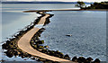
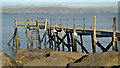
Causeway to Rough Island (4)
by Albert Bridge for square J4968 Category: Causeway See J4968 : Causeway to Rough Island (3). The causeway (covered) seen a few minutes after high water... (more)
|
|
Outfall, Holywood - February 2014
by Albert Bridge geograph for square J3979 See J3979 : Outfall, Holywood (November 2011). The same outfall five minutes after low water,... (more)
|
|
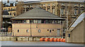
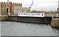
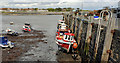
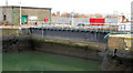
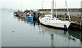
The Hamilton Dock entrance, Belfast (2)
by Albert Bridge geograph for square J3475 The entrance to the Hamilton Dock approximately an hour after high water.... (more)
|
|
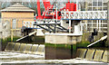
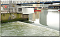
The Lagan Weir, Belfast (2013-1)
by Albert Bridge geograph for square J3474 About 90 minutes before high water, the sea water flowing over the weir into the... (more)
|
|
Ringneill Quay, Strangford Lough (2)
by Albert Bridge geograph for square J5265 Ringneill Quay, almost submerged, at about five minutes after high water... (more)
|
|
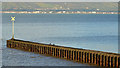
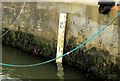
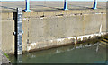
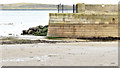
Depth marker, Portstewart harbour
by Albert Bridge for square C8138 The marker showing the depth of water available at Portstewart harbour. The... (more)
|
|
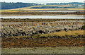
The loughshore, Reagh Island near Comber (2)
by Albert Bridge geograph for square J5264 The shore of Strangford Lough, along the Ringneill Road, to the north of here... (more)
|
|
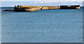
Ballywalter harbour (1)
by Albert Bridge geograph for square J6369 A small harbour, on the east coast of the Ards Peninsula, between Donaghadee and... (more)
|
|
Causeway to Rough Island (12)
by Albert Bridge geograph for square J4968 See J4968 : Causeway to Rough Island (11). The causeway, to Rough Island, 55 minutes after high water... (more)
|
|
Causeway to Rough Island (11)
by Albert Bridge geograph for square J4968 The causeway, to Rough Island, 47 minutes after high water Killyleagh and five... (more)
|
|
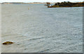
The North Pier, Donaghadee (2)
by Albert Bridge geograph for square J5980 See J5980 : North Pier, Donaghadee (1). The North Pier at about 3½ hours after high water. For the... (more)
|
|
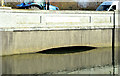
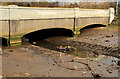
The Hamilton Dock entrance, Belfast
by Albert Bridge for square J3575 Category: Dock entrance The gate and entrance to the dock 18 minutes before low water Belfast.... (more)
|
|
Ballywalter harbour (July 2015)
by Albert Bridge geograph for square J6369 See J6369 : Ballywalter harbour (1) (May 2012). A comparison, some 40 minutes before high water... (more)
Tags:
place:BallywalterX
top:Docks, HarboursX
subject:HarbourX
HarbourX
MistX
Sea MistX
Tidal Variation
|
|
Depth marker, Carrickfergus harbour (May 2015)
by Albert Bridge for square J4187 A depth marker, about 90 minutes after high water, at the north western corner... (more)
Tags:
place:CarrickfergusX
Carrickfergus HarbourX
Depth MarkerX
top:Docks, HarboursX
HarbourX
subject:HarbourX
Tidal Variation
|
|
The North Pier, Donaghadee (February 2015)
by Albert Bridge geograph for square J5980 The North Pier, Donaghadee, about 50 minutes after low water, with plenty of wet... (more)
Tags:
top:Docks, HarboursX
place:DonaghadeeX
Donaghadee HarbourX
subject:HarbourX
HarbourX
Mole / PierX
Tidal Variation
|
|
Yacht club jetty, Holywood - February 2014
by Albert Bridge geograph for square J3979 See J3979 : Yacht Club jetty, Holywood (6 January 2014). The flood alerts of early January 2014 are... (more)
|
|
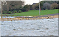
High water, Seapark, Holywood
by Albert Bridge geograph for square J4079 The loughshore, at Seapark, about 30 minutes before high water, four hours... (more)
Tags:
place:Belfast LoughX
top:CoastalX
Full MoonX
High TideX
place:HolywoodX
LoughshoreX
ShoreX
Spring TideX
Tidal Variation
TideX
|
|
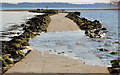
The causeway to Cross Island, Strangford Lough (2)
by Albert Bridge geograph for square J5264 See J5264 : The causeway to Cross Island, Strangford Lough (1). The causeway connecting the Ringneill Road and Reagh island to... (more)
|
|
The causeway to Cross Island, Strangford Lough (1)
by Albert Bridge geograph for square J5264 The causeway connecting the Ringneill Road and Reagh island to Cross Island... (more)
|
|
The Connswater, Belfast (18)
by Albert Bridge geograph for square J3674 The Connswater as it flows under the two eastern arches of the Mersey Street... (more)
|
|
The Lagan weir, Belfast (19)
by Albert Bridge for square J3474 The Queens Quay side of the Lagan weir, 20 minutes after sunset. The weir gate... (more)
|
|
The Lagan Weir, Belfast (18)
by Albert Bridge geograph for square J3474 Another in the series showing the weir at different states of the tide. Today... (more)
|