|
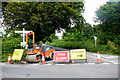
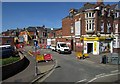
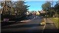
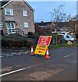
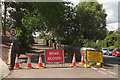
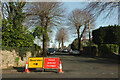
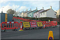
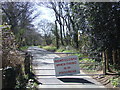
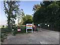
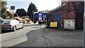
Road Closed at Hawkchurch Cross
by Nigel Mykura
geograph for square SY3499
A plethora of sign at the crossroads showing the road to Westhay is closed. As... (more)
|
|
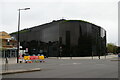
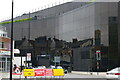
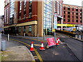
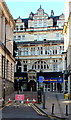
Ipswich: Willis Faber building
by Christopher Hilton
geograph for square TM1644
This office building, designed by Norman Foster for the insurance firm Willis... (more)
|
|
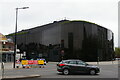
Ipswich: Willis Faber building
by Christopher Hilton
geograph for square TM1644
This office building, designed by Norman Foster for the insurance firm Willis... (more)
|
|
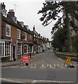
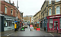
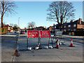
Road Closed and Diversion signs at the SW end of High Street, Marlborough
by Jaggery
geograph for square SU1868
Temporary signs in place on October 14th 2017. High Street is closed to traffic... (more)
|
|
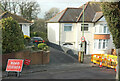
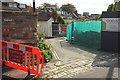
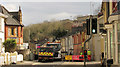
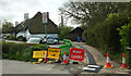
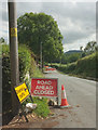
Thurlow Road, Exeter, closed
by Derek Harper
geograph for square SX9393
The one-way street is closed for sewer works. Seen from a park and ride service... (more)
|
|
Ipswich: Willis Faber building
by Christopher Hilton
geograph for square TM1644
This office building, designed by Norman Foster for the insurance firm Willis... (more)
|
|
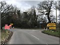
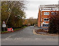
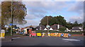
Closed north end of B5367
by Jonathan Hutchins
geograph for square SJ7849
The road is closed at this point to enforce the diversion on the right along... (more)
|
|
M3 closed sign, Belfast (August 2015)
by Albert Bridge
for square J3474
|
|
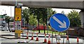
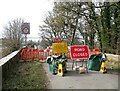
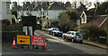
Temporary road closure on High Street, Glinton
by Paul Bryan
geograph for square TF1505
High Street in Glinton was temporarily closed near the post office and Nisa... (more)
|
|
Close season, Torre #5
by Derek Harper
geograph for square SX9065
|
|
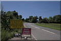
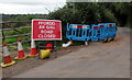
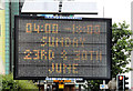
Road Closed sign
by Bob Harvey
geograph for square TF0819
The yellow sign reads
"A15 closed here from 12th July until 30th July for... (more)
|
|
"Road closed" sign, Belfast (1)
by Albert Bridge
for square J3474
A portable solar-powered road sign, at Victoria Street, warning that High Street... (more)
|
|
Cotham Hill closed
by Derek Harper
geograph for square ST5774
|

|
Old Mill Road closed
by Derek Harper
geograph for square SX9063
|
|
Junction on Torquay seafront in snow
by Derek Harper
geograph for square SX9163
Where Shedden Hill Road (behind camera) and Belgrave Road (right) meet the A379... (more)
|
|
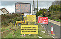
The Ballysallagh Road, Bangor (November 2017)
by Albert Bridge
geograph for square J4779
The Ballysallagh Road is closed, at the Crawfordsburn Road corner, following... (more)
|
|
Road Closed on the B4380
by TCExplorer
geograph for square SJ5905
The road is closed for up to 3 months due to structural works taking place on... (more)
|
|
Welsh / English temporary signs, Rowan Way, Newport
by Jaggery
geograph for square ST3090
Showing ROAD CLOSED / DIVERSION and their Welsh equivalents. Rowan Way beyond... (more)
|
|
Road closed, Bell Bridge
by Adrian Taylor
geograph for square NY3642
|
|
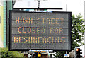
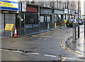
High Street closed to traffic, Newport
by Jaggery
geograph for square ST3188
On November 13th 2019 a temporary sign showing ROAD CLOSED
and its Welsh... (more)
|
|
Road Closed sign facing Beach Road, Southerndown
by Jaggery
geograph for square SS8873
In September 2019 the Road Closed sign is at the edge of an unnamed side road on... (more)
|
|
Closed road, Galmpton
by Derek Harper
geograph for square SX8856
Old Road is not intended for through traffic anyway, as the sign on the left... (more)
|
|
Elliston Lane, Redland, closed
by Derek Harper
geograph for square ST5874
|
|
Business as usual signs, Craigantlet (November 2017)
by Albert Bridge
geograph for square J4376
Road closed and business as usual signs, on the road to Bangor, at... (more)
|
|
Road closure sign, Glenmachan, Belfast
by Albert Bridge
geograph for square J3975
One of several signs locally warning of closures on Craigantlet Hill... (more)
|
|
Close season, Torre #3
by Derek Harper
geograph for square SX9065
Parkhurst Road seen from the T junction with St Vincent's Road. As the... (more)
|
|
Road closed signs on Stone Wood Lane, Shepley
by Humphrey Bolton
geograph for square SE1810
The 'road narrows' sign is perhaps a warning that if motorists... (more)
|
|
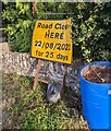
Bilingual temporary road sign, Church Road, Llandegveth
by Jaggery
geograph for square ST3395
The sign in place on November 21st 2021
shows "ROAD CLOSED" and the... (more)
|
|
Yellow temporary sign, Upper Dock Street, Newport
by Jaggery
geograph for square ST3188
On the corner of Skinner Street viewed on March 11th 2021. The sign shows... (more)
|
|
Raleigh Avenue closed
by Derek Harper
geograph for square SX8964
The steep road is closed from the junction with Queensway, causing confusion... (more)
|
|
FFORDD AR GAU/ROAD CLOSED, Bettws Hill, Newport
by Jaggery
for square ST2890
A temporary Welsh/English FFORDD AR GAU/ROAD CLOSED sign, cones and
Welsh Water... (more)
|
|
Hele Road closed
by Derek Harper
geograph for square SX9066
A significant closure; the B3199 acts as a ring route around the centre of... (more)
|
|
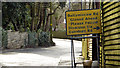
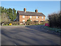
Hunters Hall, Trow Lane
by Vieve Forward
geograph for square SU0181
This house, named Hunters Hall on the OS map, dates from 1863. The signs refer... (more)
|
|
Walcot Lane, Pershore
by Jaggery
geograph for square SO9447
Viewed across Station Road. Permanent signs show Ford 300 yds (ahead) and Road... (more)
|
|
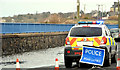
Flooding, Holywood (2)
by Albert Bridge
geograph for square J3979
14.06 The Esplanade closed to traffic as the water level rose.
|
|
"Road closed" sign, Belfast (2)
by Albert Bridge
for square J3474
|
|
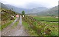
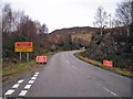
Road closed, Gleann na Cìche
by Craig Wallace
geograph for square NH1218
A rather unexpected road sign on this remote track. The sign says the track is... (more)
|
|
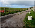
Weir Lane near Rowhedge
by Malc McDonald
geograph for square TM0121
Weir Lane crossed an MoD firing range. When firing is taking place, the road is closed.
|
|
Road closed, Cott
by Derek Harper
geograph for square SX7861
Cott Lane is closed, and vehicle access to the Cott Inn's car park is only... (more)
|
|
Close season, Torre #7
by Derek Harper
geograph for square SX9065
|
|
Old Woods Hill closed, Torquay
by Derek Harper
geograph for square SX9065
|
|
Harley Thorn Lane closed
by Jonathan Hutchins
geograph for square SJ8439
|
|
Road closed ahead and diversion signs
by John Baker
geograph for square TR2343
|
|
Road closure signs on Hardy Lane, Chorlton
by Phil Champion
geograph for square SJ8192
The planned extension of the Metrolink network to Manchester Airport will see... (more)
|
|
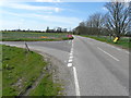
A890 road closure, January 2012
by Richard Dorrell
geograph for square NG8427
This is the start of the A890 at its junction with the A87 in Auchtertyre. The... (more)
|
|
Northern Hexham to Whitby service at level crossing on west side of Prudhoe Station
by Roger Templeman
geograph for square NZ0863
The train is formed of diesel multiple units 158 851 and 156485. The building on... (more)
|
|
Yellow road closure sign, The Vineyard near Walterstone Common
by Jaggery
for square SO3323
Temporary sign at the western end of the road named The Vineyard on September 11th 2022.
|
|
Welsh/English Road Closed sign, Corn Street, Newport city centre
by Jaggery
geograph for square ST3188
The bilingual temporary sign on the approach to
Commercial Street is in place... (more)
|
|
Ashburton Road, Bovey Tracey
by Derek Harper
geograph for square SX8177
The road is closed to vehicles, probably until August 2021, but pedestrians and... (more)
|
|
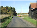
Road Closed
by Keith Evans
geograph for square TL7739
Road closed sign near to Little Yeldham, Essex.
|