Exploring SE0721, Upper Greetland
![Creative Commons Licence [Some Rights Reserved]](https://s1.geograph.org.uk/img/somerights20.gif)
Great Britain 1:50 000 Scale Colour Raster Mapping Extracts © Crown copyright Ordnance Survey. All Rights Reserved. Educational licence 100045616.
Contents
- 1. Introduction
- 2. The Roads
- Rochdale Road
- Turbury Lane
- Scar Bottom Lane
- Brian Royd Lane
- 3. The Public Bridleways
- Bridleway 4, Bilberry Hall Lane
- Bridleway 43
- 4. The Public Footpaths
- Footpath 41, Norland Road to Moor Bottom Lane
- Footpath 42, Scar Bottom to Bilberry Hall
- Footpath 43(A), Cat Lane
- Footpath 43(B), Syke House Lane
- Footpath 48, Dog Lane
- Footpath 50, High Trees Lane and Dog Lane
- Footpath 51(A) Crawstone Hall to Rochdale Road
- Footpath 51(B) Dog Lane to Saddleworth Road
- Footpath 52
1. Introduction
| This square contains gently-sloping farmland in the north half, which was formerly Greetland Moor. It has been gradually enclosed, starting at Turbury during the 18C or earlier, and not completed until the second half of the 20C. Rochdale Road runs along the top of a steeper slope, which being south-facing was enclosed for farming much earlier. There are 17C farmhouses, and one of them was recorded in 1519. This land is in the valley of Black Brook. Apart from farming, there have been sandstone quarries. It is in the rural part of Greetland, which was a township in the parish of Halifax and later was combined with Elland as a civil parish. When Greetland became an urban district council, separate from Elland, in 1894 this upper part was excluded and became a civil parish in Halifax Rural District. In 1937 all of Greetland was absorbed by Elland UDC, which in turn was absorbed by Calderdale Council in 1974. | [map SE 07 21] |
In the text, 'Footpath' has generally been abbreviated to 'FP', and 'path' has been used for the right-of-way, even if there is no visible track. 'Path on the ground' is the practical route, where it differs from the actual right-of-way. I have described the footpaths in numerical order, with maps to show the start and end points. All the rights-of-way are prefixed by 'Elland'. I have generally not mentioned modern houses individually.
In order to follow the descriptions, the 1:25,000 map on geograph would be useful, and can be obtained in a small window by clicking on the map on the SE0721 page or an image page. You might like to follow the roads and paths on the large-scale OS map on the Calderdale Council site:
Link
For large-scale maps with rights-of-way, select 'Transport networks'. I usually choose the monochrome version, and then search for, eg, '1 Turbury Lane'.
The site also includes old maps at six inches to the mile. Select 'historical maps' and choose the date of the map. You can adjust the zoom level and change instantly between four editions of the OS six-inch map from 1851-5 to 1934-48.
For historical maps at 1:2500, see the 'old-maps' website:
Link
Enter the all-figure grid co-ordinates at the centre of the area you wish to see, i.e. a prefix of 4 before both eastings and northings instead of SE. The window for 1:2500 maps is approximately 970m wide by 680m high. You cannot pan the maps, but have to re-enter new co-ordinates and wait for the map to reload.
For details of listed buildings see:
Link
Details of buildings are seen by selecting them from little triangle symbols on a large-scale OS map, I have found that searching for 'High Trees Lane' gets you to this area.
The maps that I have referred to most frequently are the Ordnance Survey First Edition map at six inches to the mile, West Riding Sheet 245, published c.1850, and the 1:2500 map published in 1893.
Digital copies of Thomas Jeffreys's map of Yorkshire, 1775, the map of the Parish of Halifax, 1835, by J F Myers, and the OS six-inch maps of the West Riding of Yorkshire, c.1850, are available from the Digital Archives Association.
2. The Roads
Rochdale Road
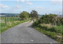
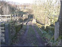
Rochdale Road is an ancient, probably medieval route. It is now the B6113. It is on Ogilby's Road from York to Chester, Plate 89 of his road book 'Britannia' of 1675. The road was turnpiked by the Blackstone Edge Trust by 1773 and is shown with milestones from Elland to Rochdale on Jeffreys's map of Yorkshire, 1775 (although the 1850 map shows these as having distances to Rochdale and Ripponden). Jeffreys's map shows the road as being unfenced on the north side, so presumably Greetland Moor still came down to it. The map does, however, show an enclosure with two buildings, corresponding to Higher and Lower Turbury.Starting at the western boundary of the square, there is soon a stile on the left at the end of Footpath 44. This slants sharply leftwards and straight out of the square, so will not be described further. It is shown on the 1850 map. The 'MS' on the 1:25000 map opposite this stile is for a milestone in the next square. | [map SE 0700 2132] | |
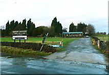
Next on the left is the entrance to Greetland Allrounders Rugby League Club, on land that was still rough pasture in 1850. | ||
Soon we reach Dog Lane on the right. The speed derestriction signs are probably necessary because, although only a public footpath, Elland FP50, the lane is an unadopted street. On the 1850 map it was a lane as far as Crawstone Hall, but then only a narrow path to High Trees. | ||
On the north side of the road a big square block of land had evidently been only recently enclosed in 1850, as, apart from some small enclosures near the road, it was still shown a rough pasture, and two footpaths, which no longer exist, are shown curving across it. In this block, next to the road, there is a terrace of houses called Copperas Row. This is shown on the 1835 map, and is captioned 'Coppers Row' on the 1850 and 1893 maps. Copperas is iron sulphate and has many uses including the manufacture of dyes. Perhaps there was a small chemical works behind the houses. On the south side Crawstone Clough is a deep wooded valley. The route of the road might well have evolved before the Romans came, and keeps above the steep part of the hillside, with its rocky outcrops, and above the head of this valley. | ||
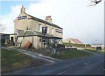
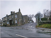
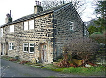
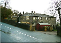
Next on the left is Bridleway 43, and opposite it Cat Lane (FP43), and then the Sportsmans Inn is on the left, and Clough Head Farm on the right. Both are on the 1850 map and a building is shown on the 1835 map in the position of the inn. Clough Head Farm is shown as five cottages on the 1893 map. | ||
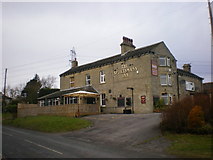
Another view of the Sportsmans Inn. Further down the road, 'The Woodlands', on the right, is in the position of Scar on the 1850 map, named on the 1893 map. Next on the right is an interesting group of houses. A row of four and then a pair were called Club Houses on the 1893 map, having been shown on the 1850 map. Club houses were built by a group of ordinary working men who clubbed together to build themselves homes. The name now is Brockstones. Next are four houses called Scar Top. | ||
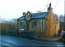
This house appeared on the 1932 map and was captioned 'Council Bungalow' on the 1964 map. It was almost certainly the offices of Upper Greetland Civil Parish. Next to it FP51 starts in a snicket. 'Whitehall', on the left is on the site of a house shown on the 1850 map, and then there are three terrace houses added by 1893. | ||
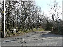
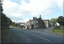
We then come to the junction with Turbury Lane on the left, with a group of houses captioned 'New House' on the 1893 map. | ||
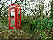
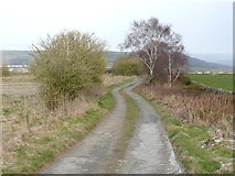
Opposite Turbury Lane there is an old red telephone box, and a signpost indicates the top of the part of FP42 that slopes down through woodland to Scar Bottom Lane. | ||
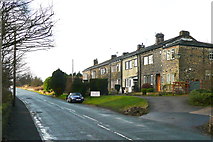
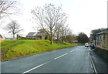
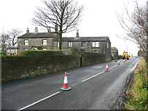
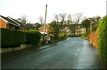
Further down the road there is a grassy bank on the left, and opposite it more houses called Scar Top. These are shown on the 1850 map. They have another two storeys at the back, facing Scar Bottom Lane which joins Rochdale Road a little further along. Rochdale Road is part of the route of Stage 2 of the 2014 Tour de France, and the riders will be travelling down here at great speed. | ||
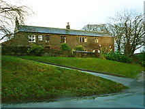
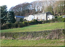
This row of three houses on the left is Crawstone Knowl Farm, called Crawstone Rock on the 1850 map and shown on the 1835 map. Crawstone Rock itself is amongst trees on the right, possibly in the next square. Whether this is a single rock or a series of outcrops is not clear. The road then leaves the square. | [map SE 0799 2132] |
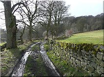
Turbury Lane
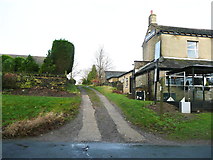
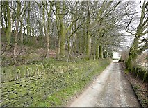
Turbury Lane starts at Rochdale Road. The house on the corner has a letterbox built into the wall. The house could have been a shop, but I have not found a map to show it as a post office, and would not have expected one here. The 1835 map shows it as a straight road through enclosed lane as far as Greetland Moor, hence the name, which suggests a road along which peat was carted. The 1850 map shows that it continued over the moor to Norland. | [map SE 0770 2137] |
Prospect House is on the left. This is on the 1850 map. There are two houses; the one on the right looks older, and is shown as three houses on the 1894 map. | |
Further along, on the right, Higher Turbury was just called 'Turbury' on the 1850 map. | |
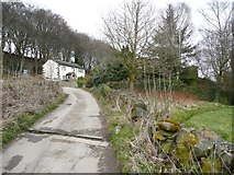
 Here we are part way across the former Greetland Moor. The bridleway on the right and Stockley House further up the road on the left do not appear until the 1893 map. As the road leaves the square, approaching Clough Moor Bridge, there are some houses on the right that were built in the mid-20C. | [map SE 0734 2172] |
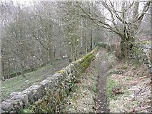
Scar Bottom Lane
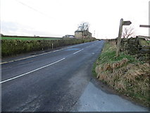
This road starts at Saddleworth Road, in the square to the south. Opposite the junction, however, there is a bridleway called Gate Head Lane which passes Gate Head and becomes Stubbing Lane, leading eventually to Beestonley Lane. This was obviously a through route from Rochdale Road before Saddleworth Road was constructed as a turnpike road in the early 19C. | [map SE 0771 2100] | |
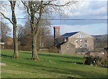
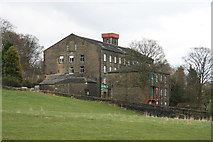
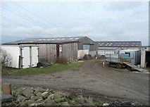
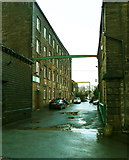
From the road you can see Brian Royd Mill, shown on the 1850 map as a cotton mill, and now a business centre housing various companies (see also Brian Royd Lane). | [map SE 0795 2105] | |
19th century mill originally used for shoddy and mungo. Now a business centre. Lacking its chimney like so many others. by Chris Allen | ||
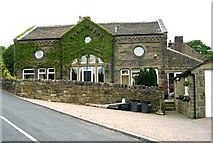
The road passes this rather nice Coach House. Surprisingly it is not a listed building, and is puzzling in that it is not near a large house. The nearest, Brian Royd, had a coach house next to it. | ||
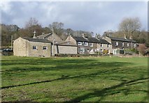
There is a row of houses called Gate behind the Coach House. This name is shown on the 1835 map. | ||
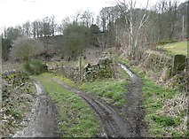
Next there is a crossroads, where Brian Royd Lane goes to the right, Scar Bottom Lane carries straight on as an unadopted street, and Syke House Lane, unsurfaced and also an unadopted street only classed as a footpath, goes to the left. The 1850 map has the old spelling 'Sike'. | ||
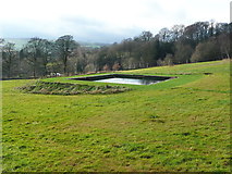
Continuing up Scar Bottom Lane, the field on the left is the site of Saltaire Mill, shown as disused on the 1893 1:2500 map. The rectangular reservoir that presumably supplied the mill still exists. | ||
The 'Scar' is a steep bank below Rochdale Road. There was perhaps a natural cliff, and Scar Delf (sandstone) is shown on the 1850 map. There are now houses at the foot of the bank. | ||
When the houses are reached, Scar Bottom Lane bends sharply to the right, and on the left is this access road to houses on the site of Scar Bottom Mill. This was a woollen mill, and buildings and tenter frames are shown on the 1850 map, although the mill is not named. FP42 goes to the right beyond the bin. | ||
These houses are all that remains of the mill buildings. | ||
At the site of the mill a tarmac drive goes down to a group of recently-built houses. | ||
These are the houses, seen from Syke House Lane. | ||
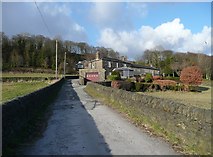
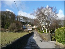
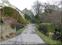
Turning right, the lane climbs up to Rochdale Road past modern houses and then passes the back of a row of houses facing the main road (Scar Top, shown on the 1850 map). | ||
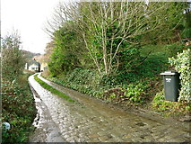
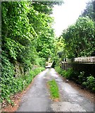
This is the lane, looking down from Rochdale Road. | [map SE 0793 2132] |

Brian Royd Lane
Brian Royd Lane starts at the junction with Scar Bottom Lane and leaves the square before reaching Rochdale Road. On the 1850 map it passes two groups of houses, Brook Row and Bryanroyd. Brook Row has its back to the road; this is a view of the front, from FP52. | [map SE 0786 2114] |
Trenance Gardens is a housing estate built on land between Brian Royde and Brian Royd Mill. This land was probably part of the Brian Royd estate, as the 1850 map shows a path across the field between the two buildings, which looks like a driveway on the 1893 map. This view is looking up towards Brian Royd Lane. Note the variation in spelling. | |
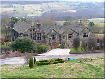
Next, on the right, is this pair of houses, which I feel sure must have been the coach house for Bryan Royd. It is not possible to take a satisfactory photograph of the house from the road. It is listed Grade II, and is described as 'a large house, early to mid C18. Hammer-dressed stone, now rendered in part, stone slate roof. Double pile plan .... Centrally placed doorway has highly decorative wrought iron porch flanked by sash windows to both floors. Tall staircase window has large painted glass pictures; the topmost heraldic, the lower of York Minster. Door of 2 fielded panels with large etched glass above. Side of cross-wing has tall staircase window with double margin lights. John and Ely Thomas Dyson (owned it) from 1822.' The latter was a cotton spinner, and lived in the house until his death in 1884. The two brothers owned and managed the mill from 1845. |
3. The Public Bridleways
Bridleway 4, Bilberry Hall Lane
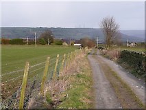
This lane starts at Turbury Lane and goes past Bilberry Hall to meet Moor Bottom Lane and continue as a surfaced lane, Scholes Lane, to Lower Greetland. It is not on the 1850 map, but is shown on the 1893 1:2500 map as a track along the edge of what remained of Greetland Moor after the land to the south of it was enclosed. The area on the left is still called Greetland Moor on the 1:25,000 map, and shown as rough pasture. | [map SE 0736 2180] |
This is the lane a little further to the east. The wall is straight, but the roadway curves. | |
Further east again, and Bilberry Hall is now in sight. | |
 This is the lane at the eastern edge of the square, looking towards Bilberry Hall. | [map SE 0795 2195] |
Bridleway 43
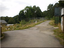
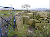
This is the start of the bridleway at Rochdale Road, next to the Sportsmans Inn and opposite Cat Lane. On the 1850 map a block of land north of Rochdale Road and west of Turbury Lane is shown as fields, and this lane is shown running north from Rochdale Road between the west and east halves of the block, and leading to unenclosed land captioned 'Black Pasture'. | [map SE 0733 2137] | |
A branch of FP41 meets the bridleway in the foreground on the right, and going off the left is a stream, walled on both sides. This view is looking back towards Rochdale Road. | ||
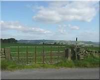
On the 1893 map the eastern part of Black Pasture had been enclosed, and the track extended up the edge of the rough pasture to Stockley House. Even on the 1984 1:10,000 map Black Pasture is still shown as 'rough pasture', without fences alongside this track and alongside Norland Road on the western side. Today Black Pasture is improved pasture, but is still one large field, separated from the track by a barbed wire fence, not a wall. The map shows its junction with Turbury Lane, at Stockley House. | [map SE 0724 2183] |
4. The Public Footpaths
Footpath 41, Norland Road to Moor Bottom Lane
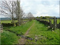
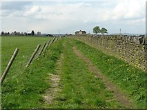
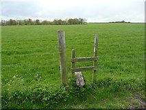
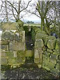
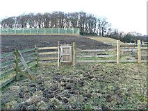
This is a long, direct footpath that starts at Norland Road and goes to the top of Stony Lane. It is shown on the 1850 map, then crossing Greetland Moor. It enters the square 100m to the west of this stile, which crosses a relatively recent fence around an area of heathland, the last remnant of Black Pasture. The map shows where the path enters the square. | [map SE 0700 2155] |
By 1893 the block of fields to the south had been created, and a new footpath is shown along the edge of Black Pasture. The junction with the original path is inside the remaining area of heathland, so there is a second stile over its boundary fence, next to the field wall. | |
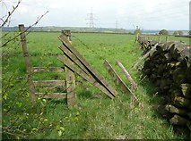
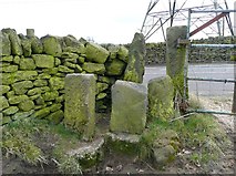
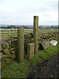
This is the junction of the path alongside the wall with the Bridleway 43. The stile is rather narrow, due to the posts on the left leaning the wrong way. | |
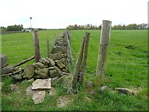
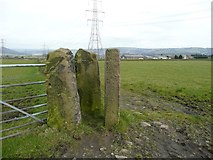
This is the stile on the main path, where it crosses the bridleway. | |
This is the stile on the east side of Turbury Lane. | |
Another view of the stile on the east side of Turbury Lane, looking back. | |
| [map SE 0762 2179] | |
This stile at the junction with FP42. From here the path continues to Moor Bottom Lane opposite Stony Lane. |

Footpath 42, Scar Bottom to Bilberry Hall
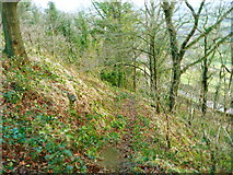
This first part of the path starts at the bend on Scar Bottom Lane, and climbs up through the woodland to Rochdale Road. | [map SE 0781 2123] |
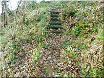
This path is not shown on the 1850 map, but is on the 1893 one. It was evidently of some importance to justify the construction of these steps. It was perhaps a shortcut for mill workers. | |
Here the path reaches Rochdale Road. You have to cross the road and go a short way up Turbury Lane, then the path continues up the driveway to Lower Turbury Farm, which was Clegg Lane on the 1983 1:10,000 map. The path goes to Bilberry Hall Lane via Far Turbury. The first part of the lane off Rochdale Road was diverted relatively recently, and the new route is not a right of way. | |
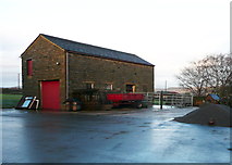
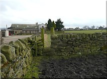
After passing the farmhouse, the footpath is to the right of this barn. | |
A narrow passage with a stile at each end leads to Clegg Lane. | |
Just before Far Turbury Farm is reached, the footpath goes to the left into the field over this stile, bypassing the farmyard. | |
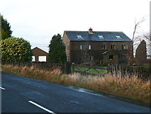
Farm buildings at Far Turbury. The farm was Lower Turbury on 1850 map. It has been owned by the Lumb family, who have farmed at Far Turbury for four generations, and specialise in suckler cows and beef production. They also own and operate Turbury Equine Liveries - this information is from their website. | |
This view is looking back at a stile on the path to the north of Far Turbury. At the north end of the field it joins FP41 and follows it to the right for a short distance, it then goes northwards to Bilberry Hall Lane opposite Bilberry hall. | [ [map SE 0785 2184] |
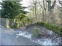
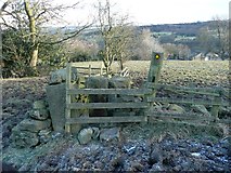
Footpath 43(A), Cat Lane
This is shown on the Calderdale transport network map as an adopted street, which is strange as it is not surfaced. It is shown and named on the 1850 map. This is the western end, off Rochdale Road. | [map SE 0732 2137] | |
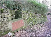
This trough was presumably either the water supply for nearby houses, or for horses to drink from. | ||
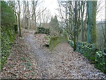
The lane is a bit narrow for carts, but about the right width for a bridleway. There is an outstanding claim for it to be upgraded to a bridleway. | ||
The lane runs parallel with Crawstone Clough, a valley cut deeply into the bedrock. | ||
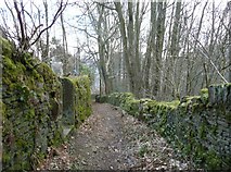
This is near to the lower end of the lane, near to its junction with Syke House Lane. | [map SE 0764 2112] |
Footpath 43(B), Syke House Lane
Syke House Lane is an unadopted street. This view is near to the eastern end, which is off Scar Bottom Lane opposite Bryan Royd Lane. It is shown and named (spelt 'Sike') on the 1850 map. | [map SE 0775 2113] |
This is the junction with Cat Lane, which is the track on the right. | |
This is at Syke House, looking back up the lane from the edge of the square. | [map SE 0760 2100] |
Footpath 48, Dog Lane
This path starts at the western end at the junction of Rochdale Road and Norland Road and descends the hillside as a walled path to a lane, which to the west is FP49. FP48 continues on the lane to the east, past Bank End, and then enters the square. Here the modern OS map calls it Dog Lane. Bank End Plantation, first shown on the 1893 map, is on the left. The lane continues to meet High Trees Lane, which is FP50. | [map SE 0711 2108] |
Footpath 50, High Trees Lane and Dog Lane
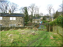
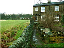
FP50, along High Trees Lane, starts at Saddleworth Road. The 1850 map shows the lane continuing southwards from the turnpike road and then entering a field, so the lane was probably made as a field access track. The lane enters the square at Lower High Trees, and this view is looking up towards Upper High Trees, where it meets Dog Lane. On the right there is a derelict barn, which is listed Grade II. The listing details state that it is of the 16C or earlier, with two bays of double-aisled timber framed construction, and that the framing of the hip appears to be original. Turning right onto Dog Lane, we pass High Trees Hall, which is listed Grade II. The listing details state that it was built c.1678 for John Ramsden (with a date stone 'IR 1678') and that is of finely dressed stone with a stone slate roof on a double pile plan. South front of two storeys and two gabled bays. Weathered plinth. String course continues round building above ground floor windows. The house has eight-light mullioned windows to the ground floor and twelve-light windows to the first floor, with hoodmould with decorative stops. Several buildings are shown here on the 1850 map, but there was only a path past them, eastwards to Crawstone Hall. The 1893 map shows a lane, as now. The name 'Dog Lane' is first shown on the 1932 1:2500 map. | |
Next we come to Crawstone Hall, which is in two parts. The eastern part (on the left in the image) is listed Grade II, and was built c.1700 as the parlour wing of the western part, which has the initials IR (John Ramsden) and the date 1631 over a doorway. This older part is not listed because it had been largely demolished, and was rebuilt in c.1982. The gate piers of c.1700 are also listed Grade II. They are not visible in this image, but are in a wall projecting from the join between the old and new parts of the house. They are of ashlar in alternate chamfered blocks topped by a pulvinated frieze and cornice with ball finials. In 'The Ancient Halls of Halifax' by Arthur Comfort (1913) there is a drawing of the house and gate piers. The text states that the property was formerly called Swaineroyde, and was awarded, along with Syke House, to Gilbert Ramsden in 1519. FP51(A) forks right along the track that crosses the image. | |
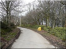
After Crawstone Hall the lane has a tarmac surface. It is an unadopted street. On the right, before the yellow grit bin, is the stile into FP51(B). | |
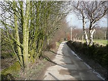
Dog Lane perhaps got its name from the 'dog-leg' bends as it follows the top of the steep sided Crawstone Clough valley and curves round a field. It is shown as a road on the 1850 map. | |
This is the junction of Dog Lane and Rochdale Road. | [map SE 0124 2141] |
Footpath 51(A) Crawstone Hall to Rochdale Road
This view is looking back towards the western end of the path, which is off Dog Lane at Crawstone Hall. It comes along a track in front of the house to this stile. The whole length of the path is shown on the 1850 map, although obscured by lettering in Crawstone Hall Wood. In front of the stile, FP51(B) joins, coming down the hillside from the right. | [map SE 0722 2115] |
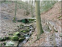
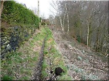
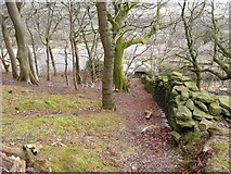
Soon the path veers to the right through a gap-stile, and goes between the stone boundary wall of the wood and a fence. It looks as if many people prefer to stay on a trodden path in the wood, which is the route shown on the 1850 map. | |
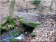
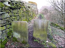
The path curves left through the wood to a bridge over Crawstone Clough. Although only a footbridge, it is wide enough for a cart. Perhaps this was necessary for woodland maintenance. The massive stones probably came from nearby quarries. | |
This is looking back down the path as it climbs gently to Cat Lane. | |
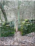
This is the stile where path reaches Cat Lane, and crosses it. | |
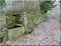
The path continues to climb gently on its way to Rochdale Road. This fine stone trough is on the left. | |
This stile seems unnecessary, but the old maps do not show woodland on the right, so the hillside, although very steep, might have been used as pasture. | |
This is the path beyond the stile, looking up towards where it turns sharp left to Rochdale Road. | [map SE 0759 2135] |
Footpath 51(B) Dog Lane to Saddleworth Road
The path descends alongside the boundary wall of Crawstone Hall Wood to meet FP51(A). It originally went diagonally across the field below, but has been diverted to allow the construction of some big sheds. It now follows FP51(A) for about 60m and then turns right through a foot-gate. | [map SE 0731 2121] |
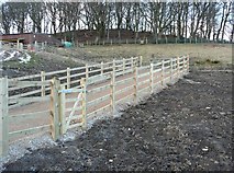
Next the path goes along a fenced approach to a horse-riding exercise yard. This involves going through two gates, which seems surprising when a slight realignment of the fences would have allowed the path to stay outside. This view and the next one are looking back up the path. | |
Next you head for another foot-gate. The land will look better when grass has covered the bare earth. | |
The next stile is awkward; it is a wooden fence across a stone gap-stile. The path continues down the field out of the square and at the bottom of the field it enters a garden, crosses it and leaves it by a very narrow stile into Syke House Lane near to its junction with Saddleworth Road. However the stile is not easy to find, and you might find yourself leaving via the garden gate. |
Footpath 52
This footpath comes along the driveway to Brook Row from Brian Royd Lane and passes through the stile in this image on its way to Brian Royd Mill and Saddleworth Road. It is shown on the 1850 map. | [map SE 0787 2113] |
The path comes through another stile from the field into the driveway of Brian Royd Mill. | |
The right-of-way goes down the driveway to Saddleworth Road, giving this view of the side of the main mill building. |
Great Britain 1:50 000 Scale Colour Raster Mapping Extracts © Crown copyright Ordnance Survey. All Rights Reserved. Educational licence 100045616.