OS 50K Symbols - Roads and paths
![Creative Commons Licence [Some Rights Reserved]](https://s1.geograph.org.uk/img/somerights20.gif)
Great Britain 1:50 000 Scale Colour Raster Mapping Extracts © Crown copyright Ordnance Survey. All Rights Reserved. Educational licence 100045616.
Contents
Click on a thumbnail to see a page with a larger photo, other photo details, and a larger section of the 1:50,000 Ordnance Survey map.
The article Ordnance Survey Map Symbols
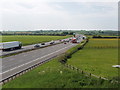
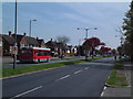
Motorway
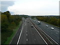
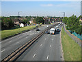
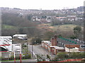
SP6702 : M40 motorway near Tetsworth
 [smallmap SP 6765 0230]
Number
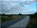
SU3714 : M271 Southbound, Southampton
 [smallmap SU 3730 1435]
Service area
Note that the name of the service area is in blue lettering.
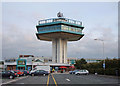
SD5052 : Forton Services, M6 (Symbol on line of motorway)
 [smallmap SD 5020 5210]
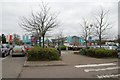
SK2401 : Tamworth Motorway Services (Symbol beside motorway; here service area is on access road from motorway junction)
 [smallmap SK 2445 0111]
Junction number
SU1980 : Westbound carriageway of M4 just east of J15
 [smallmap SU 1893 8115]
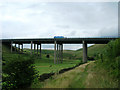
Elevated
SD9413 : M62 Viaduct
 [smallmap SD 946 138]
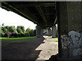
TQ1678 : Below the M4 (In this urban area, the symbol has been reduced to a V of lines on each side of the motorway where there is space on the map)
 [smallmap TQ 1695 7809]
Motorway Under Construction
TQ0476 : M25 T5 spur crossing the A3044
 [smallmap TQ 0455 7605 revA] (This map extract is from 2006 as the motorway is now built and shown on latest maps
Primary Route (A road, green lines)
TQ7326 : A21 at Silver Hill
 [smallmap TQ 7375 2605]
Primary route number
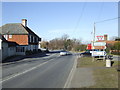
SK8490 : A631 by Woodhouse Farm
 [smallmap SK 8485 9050]
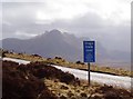
Unfenced
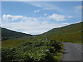
NN1457 : Pass of Glen Coe, Scotland.
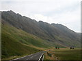 [smallmap NN 1440 5700]
Footbridge over
SX3760 : Footbridge over A38, Landrake
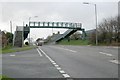 [smallmap SX 3741 6068]
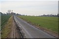
Dual carriageway
TQ2589 : A406 - North Circular Road
 [smallmap TQ 2535 8955]
Primary route under construction
SP8924 : Site of Linslade bypass, looking North
 [smallmap SP 8955 2425 revA] (This map extract is from 2006 as the road is now built and shown on latest maps
Services (same symbol as on motorway)
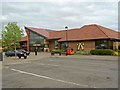
TL3565 : Cambridge Extra services
 [smallmap TL 3585 6539]
 Road bridge over river
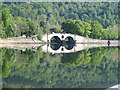
NN0909 : Double-arch bridge and reflection, Inveraray
 [smallmap NN 0981 0908]
Main road (A road, red lines)
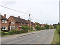
SP7804 : Longwick - residential and commercial buildings on A4129
 [smallmap SP 7890 0490]
Main road number
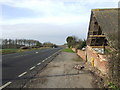
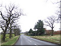
TF1479 : Tennyson Villa Farm on the A157 approaching West Barkwith
 [smallmap TF 1435 7915]
Unfenced
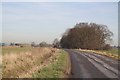
NR9946 : Boguille Hill on coast road, Arran (Dashed lines beside red line show it is unfenced, green dots show cycle route)
 [smallmap NR 9950 4675]
Dual carriageway
TA0327 : Boothferry Road
 [smallmap TA 0320 2728]
Main road under construction
ST1896 : South end of Blackwood by-pass
 [smallmap ST 1820 9655 revA] (This map extract is from 2006 as the road is now built and shown on latest maps
Secondary road (B road)
SP7903 : Houses on B4444, Princes Risborough
 [smallmap SP 7965 0355]
Secondary road number
TF0896 : Oakleigh Farm by the B1434
 [smallmap TF 0857 9615]
Unfenced
TF1080 : B1399 between Fulnetby and Holton (also shows road fenced one side only)
 [smallmap TF 1045 8025]
Dual carriageway
TQ0771 : Convent Road, Ashford
 [smallmap TQ 0755 7135]
Roads with passing places
Narrow A road with passing places
NC5956 : A836 and Ben Loyal (Symbol is dashed red line, long dashes and short gaps - the green dots show a cycle route along the road, this is also an unfenced road with dashed black lines each side)
 [smallmap NC 5995 5605]
Narrow B road with passing places
NG5618 : Corner on Elgol Road (Symbol is dashed brown line, long dashes and short gaps).
 [smallmap NG 5625 1843]
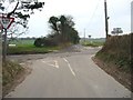
Road generally more than 4m wide
TR3246 : Crossroads to Waldershare Lane across Sutton Road Road over 4m wide (bottom left to top right of map below) crosses one under 4m wide
 [smallmap TR 3215 4695]
Unfenced SU9386 : Road through Littleworth Common
 [smallmap SU 9345 8625]
Dual carriageway
TG2823 : Minor road dual carriageway, Scottow
 [smallmap TG 2855 2315]
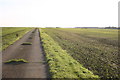
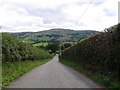
Other road, drive, or track
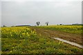
NO7598 : Track to Damhead
 [smallmap NO 7595 9815]
Road generally less than 4m wide
SD9774 : Park Rash (This example has gradient symbols as well)
 [smallmap SD 9782 7412]
Unfenced
TF1281 : Between Holton and West Torrington
 [smallmap TF 1215 8155]
Unfenced
TL2963 : Field track
 [smallmap TL 2985 6375]
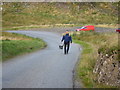
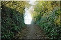
Path
NG4919 : The 'Bad Step', Skye (Path is dashed black line, the continuous black line is the high water mark symbol)
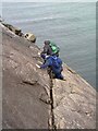 [smallmap NG 4952 1915]
Gradients
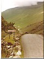
Note that arrows point downhill.Gradient 20% (1 in 5) or steeper
NY2114 : Honister Pass, Cumbria
 [smallmap NY 2197 1408]
Gradient 14% (1 in 7) to 20% (1 in 5)
SH8874 : B5383
 [smallmap SH 8860 7488]
Gate
SX4363 : The end of the road, Cargreen
 [smallmap SX 4311 6306]
ST2090 : Cattle grid on Mynydd Machen Common This symbol of a line across the road is sometimes used to denote a cattle grid, usually with the words "cattle grid" which in future may be abbreviated as "CG". But this example of a cattle grid has the line across but no words.
 [smallmap ST 2027 9047]
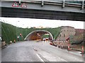
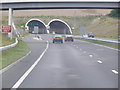
Road tunnel
TL2532 : Weston Hills Tunnel
 [smallmap TL 2535 3265]
 Ferries
Passenger ferry
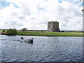
NX7462 : Ferry to Threave Castle (dashed black line with words "Ferry P")
 [smallmap NX 7405 6225]
Vehicle ferry
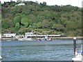
SX8752 : Dartmouth Higher Ferry and Torbay Railway train ((dashed black line with words "Ferry V")
 [smallmap SX 8799 5209]
Ferry route
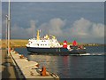
HY5140 : Ferry at Whale Geo pier, Westray
 [smallmap HY 5125 4055]
Line of former road
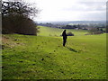
Dashed line, usually with words like "Line of Roman Road". The OS key does not show this type of dashed line, which is also used for dismantled railways.TL4901 : Mount End, Essex, on the Roman road
 [smallmap TL 4915 0125]
Great Britain 1:50 000 Scale Colour Raster Mapping Extracts © Crown copyright Ordnance Survey. All Rights Reserved. Educational licence 100045616.