The Valley of Red Beck, near Brighouse

Great Britain 1:50 000 Scale Colour Raster Mapping Extracts © Crown copyright Ordnance Survey. All Rights Reserved. Educational licence 100045616.
Contents
- Introduction
- 1. Stump Cross to Hipperholme
- 1.1 The A58, Godley Lane to Stump Cross
- 1.2 Along Red Beck to the confluence with Jum Hole Beck
- 1.3 The A58, Stump Cross to Hipperholme
- 1.4 The first turnpike road
- 1.5 Wakefield Gate
- 1.6 Paths between Wakefield Gate and the first turnpike road
- 2. The Valley of Jum Hole Beck
- 2.1 The Head of the Valley
- 2.2 The A644 and Coley Road
- 2.3 Jum Hole Beck
- 2.4 Paths west of Jum Hole Beck
- 2.5 Paths east of Jum Hole Beck
- 3. The valley of Red Beck south of Hipperholme
- 3.1 Long Lane and Marsh Delves Lane
- 3.2 Norcliffe Lane
- 3.3 Paths from Marsh
- 3.4 Sunny Bank Lane and Allen's Fireclay Works
- 3.5 Whitley Lane and Walter Clough Lane
- 3.6 Paths to the south of Walter Clough Lane
- 3.7 The road down the valley
- 3.8 The woodlands on the east side of the valley
- 3.9 The Brookfoot area and the confluence with the River Calder
Introduction
This article was inspired by a book about the valley by John S Wharton - Waltercough Valley, A History, published by the Lightcliffe and District Local History Society. This is the result of much research into archives and is illustrated by many old photographs. I have explored the area on roads and footpaths and whilst I have borrowed freely from the text in the book I have looked at the old 1:2500 maps of various dates available to view on the National Library of Scotland website, and also the six-inch maps of 1850 and the mid-20C, and written descriptons to many of the images on geograph. There are also useful websites such as the Southowram Blog on Halifaxpeople.com , which also has pages for Hipperholme and Northowram.Red Beck is the continuation downstream of Shibden Brook. The name starts at Stump Cross, where it is crossed by the A58, and it flows into the canal and the River Calder at Brookfoot.
This article is an exploration of the valley using its roads and footpaths. I have not including the built up areas in Northowram, Southowram and Hipperholme, although parts of them are in the catchment of the stream. I have used the A58 for the western and northern boundary, apart from the valley of Jum Hole Beck, the tributary stream that flows into Red Beck at Mytholme (Mytholm means a confluence of streams).
Many of the photographs were taken many years ago, and changes have often occured since. In particular there has been an increase in the growth of wild plants, especially brambles, on verges and alongside (and on) footpaths.
1. Stump Cross to Hipperholme
| [map SE 10 25] | [map SE 12 25] |
Three roads from Halifax to Wakefield pass through the northern part of the valley. The oldest, Wakefield Gate, is a packhorse track that climbs steeply out of Halifax and then descends gradually to cross Red Beck at Place Bridge before climbing steeply up to Tanhouse Lane and what is now a cross-roads at Hipperholme.
Wakefield Gate was not suitable for carts and carriages, so the first turnpike road was constructed soon after 1740. This is now Lister's Road, Shibden Hall Road, Halifax Old Road, and then meeting and replacing the old track, The Whitehall Inn was a coaching Inn at the cross roads with the turnpike from Brighouse to Denholme Gate.
This road was evidently not adequate and a new road, the present A58, was constructed with gentler gradients, crossing the ridge in a deep cutting and descending to Stump Cross, replacing an existing road, and then turning east to meet the first turnpike road at the top of Tanhouse Lane.
1.1 The A58, Godley Lane to Stump Cross
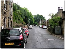
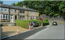
1.1.1 Godley Lane, Stump Cross, Hough[smallmap SE 100 257]
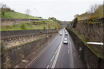
The A58 was constructed as a turnpike road c.1825. To reduce the gradient of the road between Halifax and Stump Cross there is a deep cutting through the ridge
The road goes straight down the hillside.
Buildings with dates are a useful aid when trying to learn how the style of building has evolved, although this type of door and window surround was current for a long period. The date is 1779. The large windows would originally have had mullions (upright stones to divide the windows into separate lights), probably two for each window.
by Humphrey Bolton
Hough, previously spelt 'Haugh', is the old road up to Northowram village.
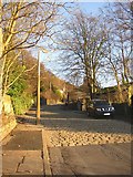
When the road gets steep, the stone setts start! Hough is the somewhat curt name for the old road from Stump Cross up to the village.
by Humphrey Bolton
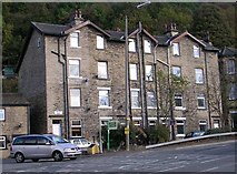
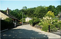
Four-storey houses at Stump Cross. Looking at the large-scale OS map on the Historic England map search, it seems that, despite appearances there are four houses at the front and four at the back, presumably only of two stories plus an entrance stairway because the land slopes so steeply.
Sandwiched between Leeds Road and the rapidly climbing Bradford Road.
by Humphrey Bolton
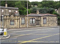
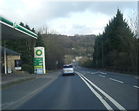
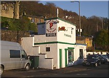
Godley Lane Toll House (and weigh engine) by the A58, in parish of Halifax (Calderdale District), was The Newsagents (Godley Lane Toll, Stump Cross), Bradford Road, Stump Cross, HX3 7AY.
West Yorkshire Archaeology Advisory Service (WYAAS)
WYHER number: MWY5075 Link
Surveyed
Milestone Society National ID: YW.HAL
West Yorkshire Archaeology Advisory Service (WYAAS)
WYHER number: MWY5075 Link
Surveyed
Milestone Society National ID: YW.HAL
by Milestone Society
Shared Description
- Link/">National Survey of Wayside Features by The Milestone Society
1.1.2 Old Godley Lane
[smallmap SE 104 260]
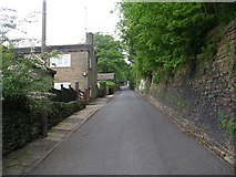
Old Godley Lane is the old road from Halifax to Bradford. It crosses the valley alongside the A58 at a lower level
Old Godley Lane descending into the valley. Godley Mill (card and wire) was next to Old Godley Lane in 1850, but had been demolished by 1892.
This path goes up to Godley Lane (the A58) and continues on the other side, but you would have to sprint to get across safely!
by Humphrey Bolton
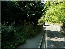
The upper path, starting alongside the fence to the left, is not shown on maps, but is defined by a strip of tree cuttings on each side and appears to be well-used.
by Humphrey Bolton
Here the old road across the valley climbs up to the A58 at the Stump Cross Inn.
by Humphrey Bolton
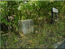
Is this a guide stone? I thought I could see a faint letter inscribed at top left, possibly filled with lead.
by Humphrey Bolton
1.2 Along Red Beck to the confluence with Jum Hole Beck
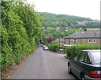
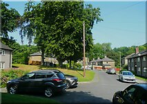
1.2.1 Shibden Grange Drive[smallmap SE 107 260]
This housing estate has some long blocks of terrace houses. The road is the original drive to Shibden Grange, widened. The house has gone, but the stable, or carriage house, block has been converted into two houses.
by Humphrey Bolton
Shibden Grange has been demolished, but the stable or carriage house block has been converted to houses and can partly be seen near the right edge of this image.
No doubt this was planted as a sapling when the housing estate was built.
by Humphrey Bolton
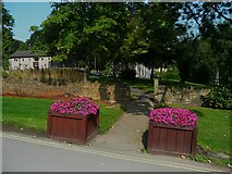
The residents are lucky to have a large pleasant park a short walk away.
by Humphrey Bolton
1.2.2 Red Beck Road
[smallmap SE 108 261]
This road led to a group of houses called Red Beck, which have gone and their land absorbed into the park and woodland.
by Humphrey Bolton
This has a barrier across it and is not a normal vehicle access to Shibden Park. The beck here is the boundary between Halifax and Northowram.
by Humphrey Bolton
The group of houses called Red Beck was a little further on; the site is now woodland.
by Humphrey Bolton
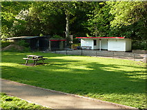
1.2.3 Shibden Park
[smallmap SE 108 258]
I thought gulls were supposed to stay by the sea in summer.
by Humphrey Bolton
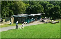
The track is an elongated circuit along the north side of the lake.
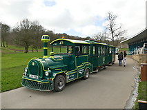
Waiting for passengers outside the cafe. The train takes passengers on a 15 minute tour of the park and to Shibden Hall SE1025 : Shibden Hall at the top of a steep hill.
by Graham Hogg
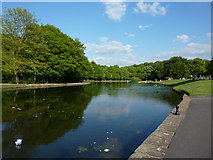
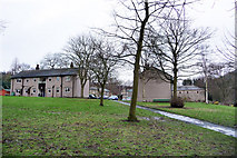
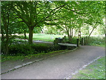
Shibden Park looking down from the terrace.
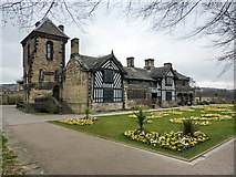
The oldest parts of Shibden Hall were built in 1420, and it has been added to over the centuries resulting in a mixture of styles. It has become famous as the home of Anne Lister (1791-1840), whose life was depicted in a BBC drama series written by Sally Wainwright, 'Gentleman Jack'. It is now a museum, and a listed building, Grade II*.
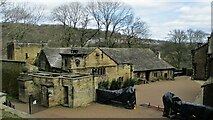
The barn houses a collection of carriages and other horse drawn vehicles. The Folk Museum in the adjacent buildings includes displays of traditional crafts. These buildings were built in the 17C and altered later; they are listed, Grade II*. The wraps cover staging props for use with filming the TV Series 'Gentleman Jack'.
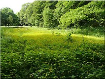
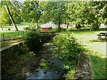
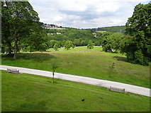
Below the miniature railway the flat land by the side of Red Beck is left to nature. Now, in mid-June, creeping buttercup is providing a show, but Himalayan balsam will grow rapidly to supplant it.
by Humphrey Bolton
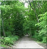
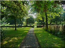
Path in North Wood, to the east of the house.
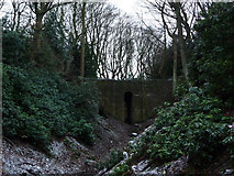
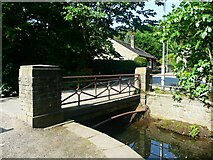
The carriage drive to Shibden Hall, constructed for Anne Lister in the 1830s, crosses the gully by means of a high, single arched bridge.
by Phil Champion
1.2.4 Shibden Park woodland
[smallmap SE 109 260]

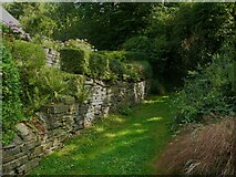
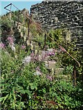
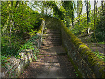
At the top of the steps the path is narrow, between walls, and partly obstructed by brambles.
by Humphrey Bolton
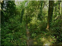
The path between the woodland an here was rather overgrown. Path-blocking plants such as brambles and nettles have thrived this summer.
by Humphrey Bolton
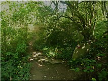
This is the continuation of the public footpath that starts at Red Beck Road. The wood is quite jungley here.
by Humphrey Bolton
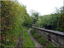
1.2.5 Footpath across the valley bottom
[smallmap SE 111 256]
There are ways into the park on the other side of the railway bridge.
by Humphrey Bolton
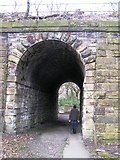
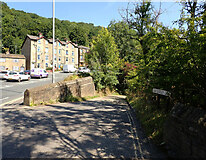
This substantial structure carries the Halifax to Bradford Railway Line (originally Lancashire & Yorkshire Railway over an apparently insignificant footbridge. However the footpath left the Magna Via (the mediaeval route from Halifax to Wakefield) in the direction of Bradford and appears to have been paved, so I guess this may have been an important route when originally established.
by Michael Steele
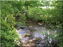
Red Beck (not Shibden Beck) between the park and the footpath.
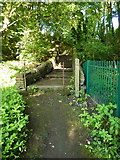
The footpath approaching the steps up to Leeds Road.
Round the corner the path goes straight up to Leeds Road. Over the road there is a footpath into the valley of Jum Hole Beck.
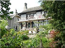
Tudor House, formerly Daisy Bank, is a rebuilding of a late medieval house moved from Halifax town centre. It is listed, Grade II.
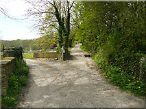
1.2.6 Breakneck Lane
[smallmap SE 114 256]
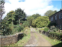
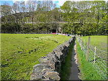
The lane keeps right here, the left turn is a private driveway.
by Humphrey Bolton
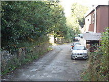
The track goes left after the building under a railway bridge.
![Creative Commons Licence [Some Rights Reserved]](https://s1.geograph.org.uk/img/somerights20.gif)
Great Britain 1:50 000 Scale Colour Raster Mapping Extracts © Crown copyright Ordnance Survey. All Rights Reserved. Educational licence 100045616.
( Page 1 2 3 4 5 6 7 8 ... next >> )