Geo-Trips :: Salisbury to Canterbury (18)
Kent Coast
A walk from Sandling, Mon, 13 Sep 2010 by Chris Heaton
| preceding leg | This trip is part of a series. |
From Sandling our route crossed the M20 and A20 to climb up Tolsford Hill with its array of radio masts. All height was immediately lost however, as we plunged down to the village of Etchinghill.
Height was once attained once more as the path took us high above the outskirts of Folkestone. Below our feet was the Channel Tunnel Terminal, every detail of the large complex could be seen from out vantage point. We continued eastwards the reach Castle Hill above the tunnel entrances.
Descending to cross the A20, we gained a narrow lane over Creteway Down to reach the eastern edge of Folkestone. The public house that was earmarked for a lunch stop happened to be closed on this day - they must have known we were coming.
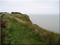
We now followed the coast along the North Downs National Trail/Saxon Shore Way over the chalk cliffs. A head for heights was needed for this section.
We visited The Battle of Britain Museum before undertaking this section, and managed to have a bite to eat as well!
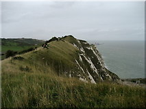
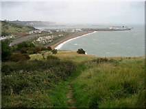
Now over Abbot's Cliff and Shakespeare Cliff - and many other cliffs. The railway, and Samphire Hoe sheer below our feet. Across the English Channel, France was clearly visible.
Gradually height was lost as we descended into Dover over the Western Heights.
Distance:- 14 miles
Click the blue circles to see a photograph taken from that spot and read further information about the location. The blue lines indicate the direction of view. There is also a slideshow of this trip. ( )
↓ Scroll down here ↓
By Willow Wood
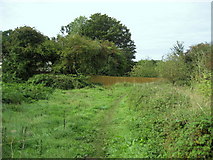
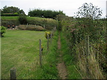
The Saxon Shore Way beside Willow Wood, near Sandling.
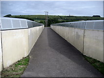
Saxon Shore Way crossing Railway
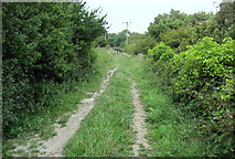
The long distance footpath crossing the railway east of Sandling Station. These... more
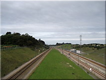
Railway East of Sandling Station
The lines include the local ones from Dover and Folkestone, plus the international... more
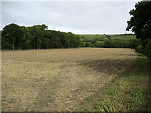
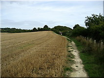
Field beside Stone Farm
Just to the north of the A20, a footpath traverses the field diagonally before... more
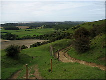
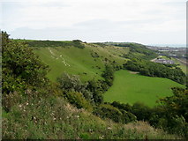
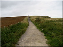
Descending off Tolsford Hill
The Saxon Shore Way descending off Tolsford Hill affords splendid views to the south west.
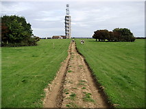
Saxon Shore Way on Tolsford Hill
Well defined track approaches the radio mast on Tolsford Hill.
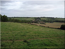
A View towards Ethchinghill
A view towards the village from the northern flanks of Tolsford Hill.
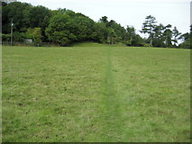
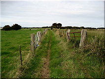
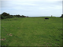
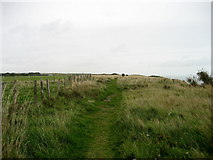
Field by Coombe Farm
The path crossing this field has been adopted by the North Downs Way, Saxon Shore... more
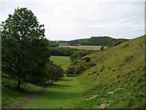
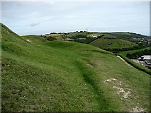
Dry Valley above Coombe Wood
This little dry valley leads down from the North Downs escarpment towards Coombe Wood.
On the Pilgrims Way
The Ordnance Survey Map marks this track as the Pilgrims Way - it is also adopted... more
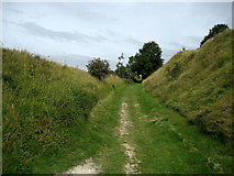
Hollow leading from Peene Quarry
A chalky hollow adopted by the Saxon Shore Way and the North Downs Way, ascending... more
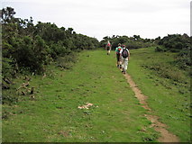
North Downs Way on Cheriton Hill
The path follows the escarpment edge on Cheriton Hill.
Folkestone White Horse
A modern carving into the North Downs escarpment on Cheriton Hill, this white... more
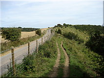
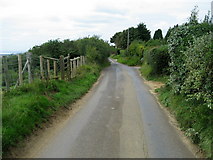
Beside Crete Road West
The lane runs side by side with the North Downs Way/Saxon Shore Way along the top... more
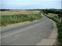
On Crete Road West
The road and North Downs Way/Saxon Shore Way all follow the top of the chalk escarpment.
North Downs Way approaching Castle Hill
Following the North Downs escarpment edge, the National Trail approaches woodland... more
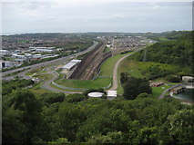
Above the Channel Tunnel Entrance
High above upon Castle Hill, the railway can be seen emerging from the Channel... more
Beside Caesar's Camp
Caesar's Camp on Castle Hill near Folkestone, marked on the Ordnance Survey as... more
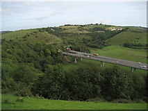
Tunnel and Flyover at Round Hill
The A20 road between Dover and Folkestone emerging from beneath Round Hill.
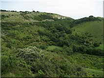
Hidden Valley below Sugarloaf Hill
A tree chocked hidden valley sandwiched between Sugarloaf Hill and Round Hill.
Crete Road East
The road on Creteway Down, adopted by both the North Downs Way and Saxon Shore Way.
Saxon Shore Way on Creteway Down
Saxon Shore Way/North Downs Way weaves in and out of gorse bushes on downland... more
North Downs Way on Dover Hill
The National Trail passes the trig point on Dover Hill.
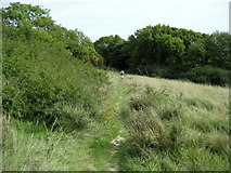
Start of Cliff Walk, East of Folkestone
For those walking the North Downs Way/Saxon Shore Way between Folkestone and Dover... more
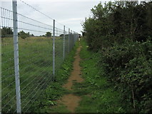
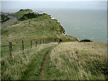
Footpath above Steady Hole
After climbing out of Steady Hole, the North Downs Way follows the boundary of... more
North Downs Way at Capel-le-Ferne
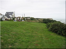
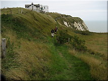
The National Trail keeps to the cliff tops on the green in front of the houses on... more
Cliff Path at Capel Court
The path at Capel Court for those walking from Folkestone to Dover.
Cliff Top Path between Folkestone and Dover
For those walking the cliff path between Folkestone and Dover, this little section... more
Track above Abbot's Cliff
The coastal path temporarily adopts this partially metalled track between... more
North Downs Way above Samphire Hoe
The National Trail on the cliff tops high above the recently created Country Park.
North Downs Way approaching Dover
The cliff path follows a ridge high above the Samphire Hoe Country Park.
Descending towards Shakespeare Cliff
The North Downs Way approaching Dover.
Descending over Shakespeare Cliff
Following the North Downs Way towards Dover.
North Downs Way on Western Heights
The National Trail compels its walkers to climb a steep hill over Western Heights... more
Clarendon Street, Dover
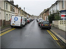
Clarendon Street as seen from Birchwood Rise, Dover.
All images © Chris Heaton and available under a
Creative Commons licence  .
.