Geo-Trips :: The Kintyre Way
Kintyre
A walk from Claonaig, Tue, 28 Sep 2021 by Anne Burgess
The Kintyre Way winds for 100 miles or so along the peninsula of Kintyre. We walked most of the second sector, omitting the stretch of tarmac road from Claonaig slipway to where the route leaves the road. The first part is on a track with fine views across to the Isle of Arran, then it degenerates to a grassy path, quite muddy in places, that climbs to about 220 metres above sea level near a group of small lochs. It then follows forest roads for a while, then another partly boggy path alongside the burn down towards Clachan, and finally a convoluted, contrived and not very enjoyable route through the woods for the final stretch to Clachan.
Click the blue circles to see a photograph taken from that spot and read further information about the location. The blue lines indicate the direction of view. There is also a slideshow of this trip. ( )
↓ Scroll down here ↓
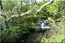
Allt a' Bhuic
A small waterfall just above the road bridge on the B842.
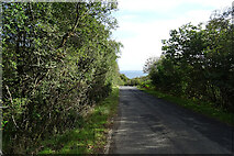
A842
The A842 is the narrow road with passing places along the east coast of Kintyre.
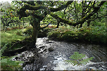
Allt a' Bhuic
Allt a' Bhuic below the A942 bridge.
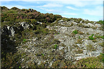
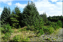
Bare Rock
I wonder if this was perhaps a quarry for building the road?
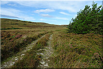
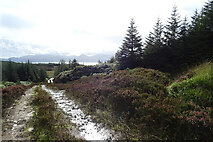
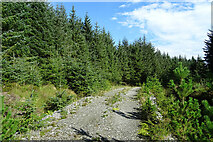
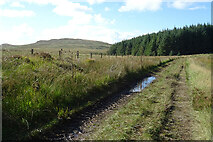
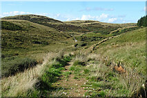
Track on Cnoc Dubh
This track is part of the Kintyre Way.
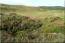
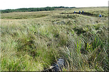
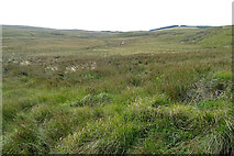
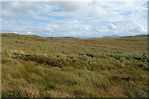
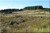
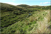
Moorland and Bog
The flattish land is probably the remnant of a post-glacial loch, and is likely to... more
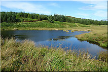
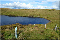
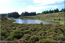
Lochan beside the Kintyre Way
The lochan is articifial, being contained by a berm.
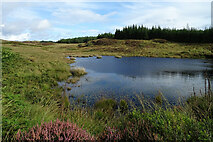
Artificial Pond
This pond or lochan is artificial, being contained by an embankment which is the... more
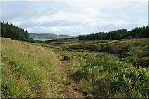
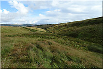
Kintyre Way
Looking back downhill, with the Isle of Arran in the far distance.
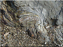
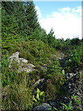
Fold by the Path
The metamorphic rock exposed here has been greatly deformed and folded.
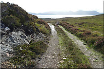
Kintyre Way
This part of the Kintyre Way is on a firm track, making for easy walking. The Isle... more
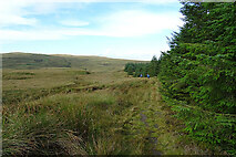
Kintyre Way
The track skirts a forest plantation, and has become much more indistinct, but it... more
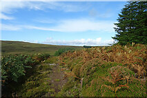
Kintyre Way
From the top of the rise here there is a glimpse of the turbines in the Freasdail... more
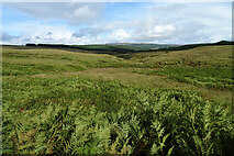
Looking towards Cruach nam Fiadh
The foreground is all in this square, but the eye is drawn to Cruach nam Fiadh on... more
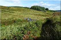
Approaching the Footbridge
The Kintyre Way crosses the Larachmòr Burn, turning sharp left to follow... more
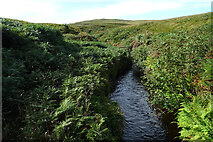
Larachmòr Burn
Looking downstream from the Kintyre Way footbridge.
Larachmòr Burn
Looking upstream from the Kintyre Way footbridge.
Kintyre Way
Looking down towards the footbridge over the Larachmòr Burn. The burn goes... more
Unnamed Burn
A minor burn that drains the east slope of Cruach nam Fiadh into the... more
Nameless Burn
This short burn drains the south slope of Cruach nam Fiadh. Looking upstream.
Nameless Burn
Looking downstream to where the burn joins the Larachmòr Burn.
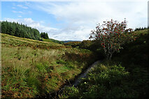
Larachmòr Burn
Or rather, a gently sloping dip through which the Larachmòr Burn flows,... more
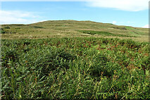
Cruach nam Fiadh
Cruach nam Fiadh ('hill of the deer') rises very gently from the Larachmòr... more
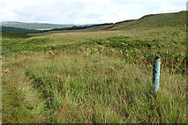
Kintyre Way
The blue post is one of the waymarkers along the Kintyre Way. The web site... more
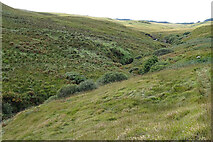
Larachmòr Burn
This part of the burn looks much more like a classic incised valley. The map shows... more
Larachmòr Burn
This section of the burn, and of course the path parallel to it, traverses steeper... more
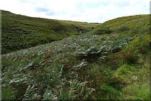
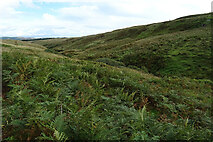
Kintyre Way
Swathes of bracken cover the slope beside the Larachmòr Burn.
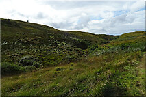
Larachmòr Burn
Looking down on the incised course of the Larachmòr Burn.
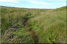
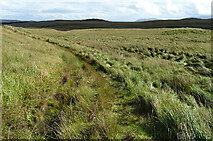
Kintyre Way
This part of the path is little more than a flattened strip in the grass, but it... more
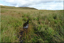
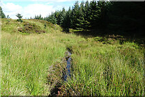
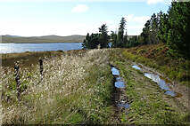
A Boggy Area
Having reached the top of the slightly steeper section of the route beside the... more
![]()
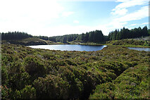
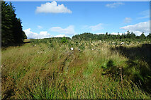
A Large Bog
The 'panoramic' format shows the extent of [[[6982154]]]. In the background are... more
Rock Outcrop
One of only a few outcrops of bare rock, most of the ground being covered by... more
Burn without a Name
A short burn that drains the south side of Cruach nam Fiadh into the bog where the... more
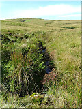
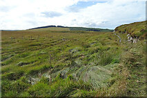
Kintyre Way
The grassy path, still easy to see and follow, on the lower slopes of Cruach nam Fiadh.
Kintyre Way
The grassy path has given way to a narrow stony path round a rocky outcrop. The... more
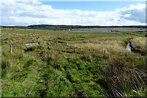
Fence across a Bog
The fence crossing the expamse of bog is the only obvious evidence of land use.... more
Lochan Fraoich
Almost certainly a kettle hole, formed by deposits of glacial material round a... more
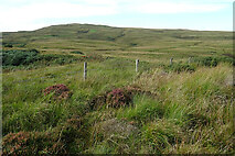
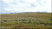
Moorland Plateau
This flattish area of grassy moorland is about 200 metres above sea level, so not... more
East End of Lochan Fraoich
This is one of the very few fences we needed to negotiate, but fortunately there... more
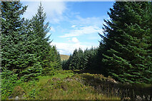
Open Woodland
There are scattered conifers on the higher ground above Lochan Fraoich.
Lochan Fraoich
Almost certainly a kettle hole, formed by deposits of glacial material round a... more
![]()
Lochan Fraoich
A 'panoramic' view of the whole of the lochan. It is almost certainly a kettle... more
Lochan Fraoich
It is almost certainly a kettle hole, formed by deposits of glacial material round... more
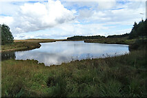
West End of Lochan Fraoich
This is almost certainly a kettle hole, formed by deposits of glacial material... more
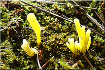
Lichen or Fungus?
I have no idea what this is. It's about an inch high and growing in the path.
Lochan a' Chreimh
It is almost certainly a kettle hole, formed by deposits of glacial material round... more
Lochan a' Chreimh
This is almost certainly a kettle hole, formed by deposits of glacial material... more
Anonymous Burn
The burn is the outlet from Lochan a' Chreimh.
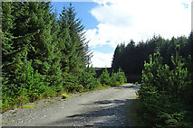
Forest Road
The Kintyre Way follows forest roads for a couple of miles from here.
Firebreak in Achaglas Forest
Looking in the general direction of Loch Chorra-riabhaich, though the trees are... more
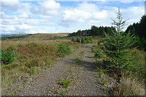
Forest Road
A well-made road, but it looks as if it is some time since it was used much.
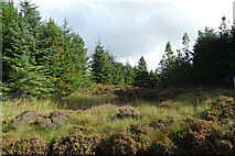
In Achaglas Forest
I wonder if this area has been felled some time ago and left to regenerate naturally?
Roadside Ditch
The ditch drains the forest road through Achaglas Forest.
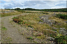
Felled Forest
This part of Achaglass Forest has been felled but not (yet?) re-planted.
Mullach Dubh
Looking towards the summit of Mullach Dubh across the felled area north of the... more
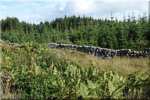
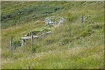
Drystane Dyke
I surmise that the dyke was originally the boundary between two estates, now both... more
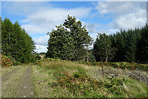
Kintyre Way
The Kintyre Way follows the forest road south of Mullach Dubh.
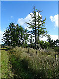
Windswept Trees
The Sycamore to the right of the forest road is being blown about by a stiff... more
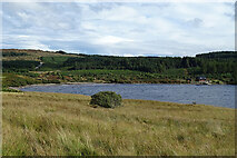
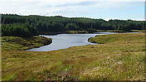
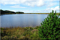
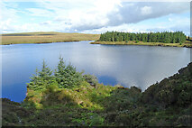
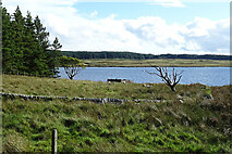
East End of Loch Ciaran
According to [[[876131]]] this may be the largest natural loch on Kintyre. It is... more
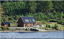
Wooden House
Thus building was not here in 2008 when [[[876131]]] was taken, but it was there... more
Track beside Loch Ciaran
The Kintyre Way follows an old track along the north shore of Loch Ciaran.
Trees by the Kintyre Way
Along most of the north side of Loch Ciaran the forest boundary is north of the... more
Young Forest
This strip of forest, oddly, extends neighbours, this block has been felled and... more
Boat House?
Some of the maps, and the satellite view, show a boat house in the position of the... more
Kintyre Way
The waymarked route follows an old track that has recently been used by a tractor,... more
Work at Loch Ciaran
There was some sort of work in progress on the shore of Loch Ciaran, but I have no... more
Kintyre Way
Having left the network of forest roads, the waymarked route follows a narrow and... more
Allt Mòr
The name of the burn seems to be alight misnomer as it means 'big burn'. It is... more
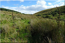
Kintyre Way
The route of the Kintyre Way here is through a patch of tussocky rushes, but it's... more
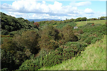
Creag Loisgte Dunultach
Open ground above the glen of the Allt Mòr, culminating on Creag Loisgte... more
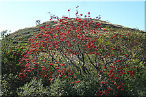
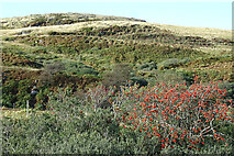
Rowan Berries
A good crop of rowan berries beside the route of the Kintyre Way.
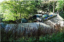
Reservoir near Clachan
The small house is marked on the map as a reservoir. Presumably it serves the... more
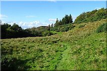
Kintyre Way
The waymarked route follows the fairly obvious path across the clearing.
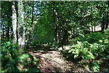
Kintyre Way
For most of the way from Claonaig, the waymarked route has followed fairly obvious... more
Kintyre Way Waymarker
If you're following the Kintyre Way from Clachan, you need to be aware that the... more
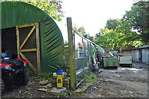
Fish Hatchery
This is part of a fish hatchery on the Allt Mòr just before it reaches... more
Fish Farm
This is part of a fish farm on the Allt Mòr just before it reaches Clachan.... more
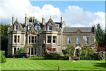
Balinakill House
The house was built in 1893, but the wing on the right is later. It is available... more
All images © Anne Burgess and available under a
Creative Commons licence  .
.