Geo-Trips :: A walk along the River Clyde in Glasgow
Glasgow
A walk from Central Station, Fri, 22 Apr 2022 by Thomas Nugent
An unplanned walk from Central Station in Glasgow city centre, around the large scale Barclay's Bank campus development at Buchanan Wharf on the south bank of the Clyde, before heading east up the riverside path as far as Dalmarnock in the east end, where regeneration and redevelopment is also taking place on a large scale.
All photos were taken with a Redmi Note 8 Pro mobile phone and its 64mb camera.
Click the blue circles to see a photograph taken from that spot and read further information about the location. The blue lines indicate the direction of view. There is also a slideshow of this trip. ( )
↓ Scroll down here ↓
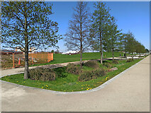
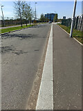
Greenway to Dalmarnock railway station
The French Street end of the new greenway path which leads to Dalmarnock railway... more
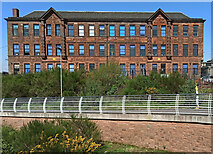
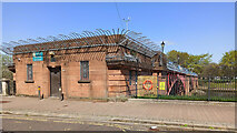
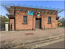
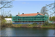
Former Strathclyde Public School
Viewed from Shawfield Footbridge over the River Clyde. Category C Listed... more
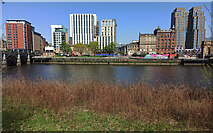
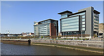
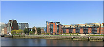
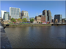
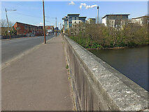
Customhouse Quay
Viewed across the River Clyde from Carlton Place.
The city skyline has changed... more
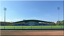
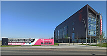
National Hockey Centre
At Glasgow Green, a legacy of the 2014 Commonwealth Games.
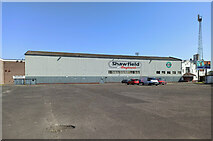
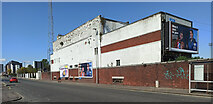
Shawfield Greyhound Stadium
Sadly in a dilapidated state and temporarily closed as a result of the Covid-19... more
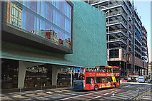
Glasgow City Sightseeing bus on Argyle Street
Outside the Radisson Blu hotel, west of Central Station.
See also [[7159015]].
Argyle Street
A new building is under construction at the corner of Robertson Street.
Argyle Street
Temporary scaffolding supporting a gable end at the corner of York Street. The... more
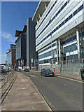
The Broomielaw
Part of Glasgow's expanding International Financial Services District (IFSD).
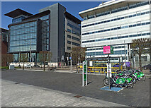
Nextbike Glasgow cycle hire point: Broomielaw
On the north bank of the Clyde.
National Cycle Network Route 75 marker on the Broomielaw
59 miles to Edinburgh (behind the camera), 204 to Carlisle and 216 to Inverness.
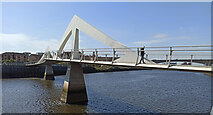
Tradeston Footbridge
Also known as The Squiggly Bridge. This bridge will see increased footfall as the... more
The Broomielaw
Viewed from Tradeston Footbridge.
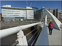
Tradeston Footbridge
Looking north from the centre of the bridge.
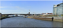
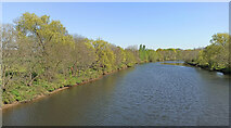
The River Clyde in Glasgow
Looking downstream from Tradeston Footbridge towards the Kingston Bridge.
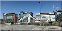
Tradeston Footbridge and The Broomielaw
Viewed from Clyde Place at the new Barclays Bank campus.
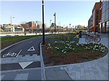
Cycle facilities at Clyde Place
Cycle lane and cycle parking at the new Barclays Bank campus.
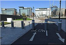
Cycle path on West Street
At the north end of West Street, at the new Barclays Bank campus.
New buildings on Tradeston Street
At Kingston Street, part of the new Buchanan Wharf campus of Barclays Bank.
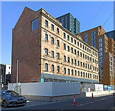
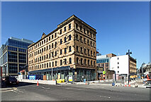
The Beco Building
Built as a drapery warehouse in 1878. Known locally as the Beco Building. Category... more
The Beco Building
Built as a drapery warehouse in 1878. Known locally as the Beco Building. Category... more
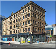
The Beco Building
Built as a drapery warehouse in 1878. Known locally as the Beco Building. Category... more

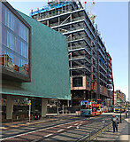
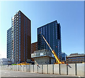
Buchanan Wharf development
Looking east along a much changed Kingston Street.
See the same view in 2016... more
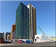
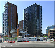
Buchanan Wharf development
Viewed across Kingston Street from Commerce Street.
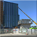
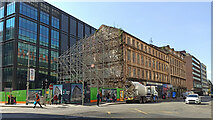
Buchanan Wharf development
The north east corner of the site at the corner of Commerce Street and Clyde Place.
Buchanan Wharf development
The north east corner of the site at the corner of Commerce Street and Clyde Place.
Buchanan Wharf development
The north east corner of the site at the corner of Commerce Street and Clyde Place.
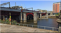
Central Station railway bridge
Also known as the Clyde Viaduct. The piers of the original bridge can be seen in... more
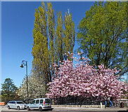
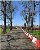
Trees on Carlton Place
At the corner of Nicholson Street.
The River Clyde in Glasgow
The north bank, looking downstream from Victoria Bridge.
The River Clyde in Glasgow
The north bank, looking downstream from Victoria Bridge.
Glasgow and Strathkelvin Sheriff Court
The Category B Listed building... more
Glasgow and Strathkelvin Sheriff Court
The Category B Listed building... more
The River Clyde in Glasgow
The Category A Listed http://portal.historicenvironment.scot/designation/LB32669... more
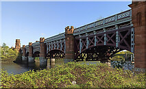
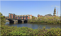
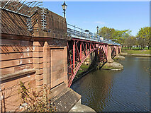
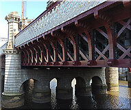
City Union railway bridge
The Category B Listed http://portal.historicenvironment.scot/designation/LB44040... more
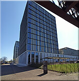
City of Glasgow College Riverside Campus
Built on the site of the former College of Nautical Studies.
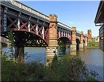
City Union railway bridge
The Category B Listed http://portal.historicenvironment.scot/designation/LB44040... more
Lifeboat training facility on the Clyde
At the City of Glasgow College Riverside Campus.
Lifeboat training facility on the Clyde
At the City of Glasgow College Riverside Campus.
The Tidal Weir
The upstream side of the weir, viewed from the south bank. Category B Listed... more
The Tidal Weir
Viewed from the south bank. Category B Listed... more
The Tidal Weir
The upstream side of the weir, viewed from the south bank. Category B Listed... more
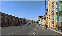
Kingston Street
The scene of great change to the streetscape in recent years.
New paintwork on Central Station railway bridge
On the downstream side of the bridge, viewed from the King George V Bridge.
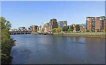
The River Clyde in Glasgow
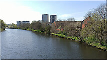
Looking across to the new developments at Customhouse Quay.
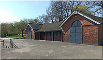
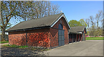
The West Boathouse, Glasgow Green
Built for Clydesdale Amateur Rowing Club in 1905. Category B Listed... more
The West Boathouse, Glasgow Green
Built for Clydesdale Amateur Rowing Club in 1905. Category B Listed... more
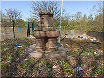
Old fountain at Adelphi Street
Sadly neglected and locked behind a high fence, due to erosion and collapse of the... more
Old fountain at Adelphi Street
Sadly neglected and locked behind a high fence, due to erosion and collapse of the... more
Riverside Tavern
Now closed and looking rather derelict.
See it in previous years [[4124073]]... more
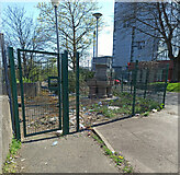
Adelphi Street
On the south bank of the Clyde, opposite Glasgow Green.
The River Clyde in Glasgow
Looking across the river from Adelphi Street to the Nelson monument in Glasgow Green.
The River Clyde at Glasgow
Looking across the river from Adelphi Street to the West Boathouse in Glasgow Green.
The River Clyde in Glasgow
A pair of nesting swans at Adelphi Street, opposite Glasgow Green.
Riverbank subsidence at Adelphi Street
The damage was caused when the nearby Tidal Weir failed in August 2017, resulting... more
Riverbank subsidence at Adelphi Street
The damage was caused when the nearby Tidal Weir failed in August 2017, resulting... more
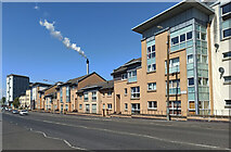
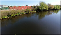
Waddell Street
Houses in close proximity to Strathclyde Distillery.
Glasgow Humane Society at Glasgow Green
Saving lives on the River Clyde since 1790 https://www.glasgowhumanesociety.org.uk/ .
St Andrew's Suspension Bridge
The south side of the Category A Listed bridge... more
St Andrew's Suspension Bridge
The south side of the Category A Listed bridge... more
St Andrews Suspension Bridge
The south side of the Category A Listed bridge... more
St Andrew's Suspension Bridge
Looking downstream to the Category A Listed bridge... more
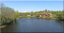
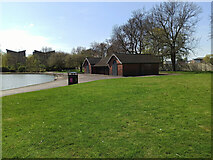
Glasgow University Boat Club boathouse
One of two boathouses on the Clyde in Glasgow Green.
Glasgow University Boat Club boathouse
One of two boathouses on the Clyde in Glasgow Green.
Glasgow University Boat Club boathouse
One of two boathouses on the Clyde in Glasgow Green.
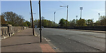
King's Bridge
Carries the A74 over the River Clyde at Glasgow Green. Early 1920s, Category C... more
King's Bridge
Carries the A74 over the River Clyde at Glasgow Green. Early 1920s, Category C... more
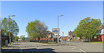
Ballater Street
West of King's Bridge.
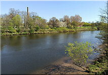
Ballater Street
With the steaming Strathclyde Distillery flue in the background.
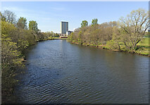
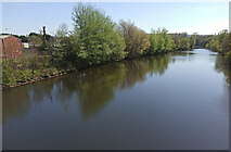
The River Clyde in Glasgow
Looking towards Oatlands from King's Bridge.
The River Clyde in Glasgow
Looking across the river to the hockey centre from King's Bridge.
The River Clyde at Glasgow
Looking downstream from King's Bridge towards Glasgow University Boat Club boathouse.
The River Clyde at Glasgow
Looking downstream from King's Bridge towards Glasgow University Boat Club boathouse.
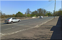
King's Bridge
Looking west into Ballater Street from the bridge which carries the A74 over the... more
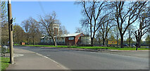
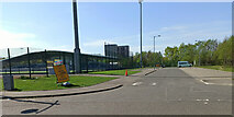
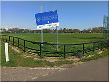
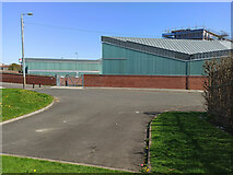
Glasgow Green Football Centre
On King's Drive, which runs through the park.
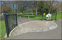
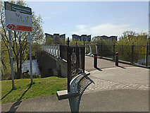
Pedestrian entrance to Glasgow Green
The fences at this entrance on King's Drive bear elements of the City of Glasgow... more
Glasgow Green Football Centre
On King's Drive, near the National Hockey Centre.
Covid-19 Test Centre at Glasgow Green
Outside the national Hockey Centre. Thankfully little used these days as the... more
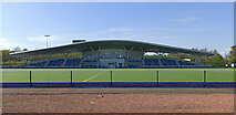
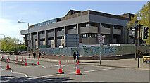
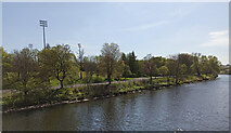
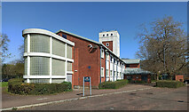
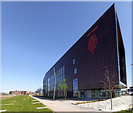
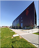
The National Hockey Centre
A legacy of the 2014 Commonwealth Games.
See the site in 2012 as construction... more
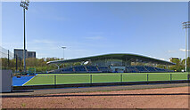
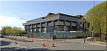
The National Hockey Centre
In Glasgow Green, a legacy of the 2014 Commonwealth Games.
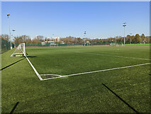
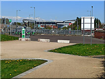
Glasgow Green Football Centre
One of the synthetic surfaced pitches as the centre.
Glasgow Green Football Centre
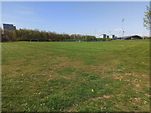
One of the grass pitches at the centre.
Glasgow Green Football Centre
A tired looking sign at the south end of the facility.
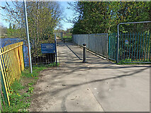
Polmadie Footbridge
The north end of the reconstructed bridge at Glasgow Green. The deck of the... more
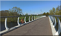
Polmadie Footbridge
Looking north along the reconstructed bridge towards Glasgow Green. The deck of... more
Polmadie Footbridge
Looking north to the reconstructed bridge towards Glasgow Green. The deck of the... more
Polmadie Footbridge
Looking downstream to the reconstructed bridge and Glasgow Green. The deck of the... more
The River Clyde and the Polmadie Burn in Glasgow
The burn enters the Clyde at the small footbridge on the right, just upstream of... more
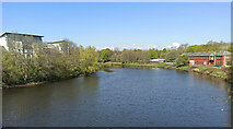
The River Clyde in Glasgow
Fairly new apartment blocks on the south bank at Haughview Terrace in Oatlands.... more
The River Clyde in Glasgow
Glasgow Green is on the right in this view from Polmadie Footbridge.
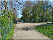
Footpaths at Polmadie Footbridge
The path on the right leads to the bridge. Straight ahead leads to a small... more
Footbridge over the Polmadie Burn
The burn enters the Clyde (seen on the left) at this point.
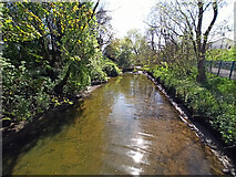
The Polmadie Burn
Looking upstream from the footbridge just before the burn enters the Clyde.
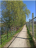
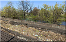
Riverside path by the Clyde
Part of Richmond Park, behind the high fence, has been given over to new housing,... more
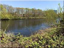
The River Clyde at Glasgow
Part of the Police Scotland building at Clyde Gateway can be seen.
The River Clyde at Glasgow
Looking downstream from the footpath at Richmond Park.
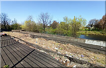
Building site in Richmond Park
The western part of Richmond Park, behind the high fence, has been given over to... more
Building site in Richmond Park
The western part of Richmond Park, behind the high fence, has been given over to... more
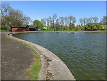
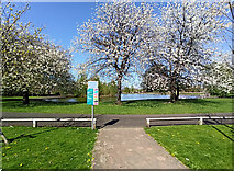
Richmond Park
The model boathouse at the model yachting pond.
Model boathouse at Richmond Park
The home of Glasgow Richmond Model Boat Club https://www.glasgowrichmondmbc.co.uk/ .
Model boathouse at Richmond Park
The home of Glasgow Richmond Model Boat Club https://www.glasgowrichmondmbc.co.uk/ .
The River Clyde in Glasgow
Looking upstream from the Polmadie Footbridge.
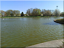
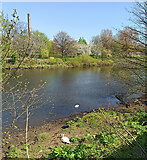
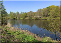
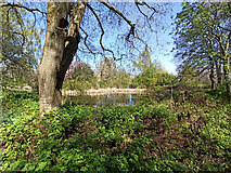
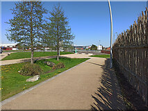
Richmond Park
The model yacht pond, with one of the Shawfield greyhound track floodlight pylons... more
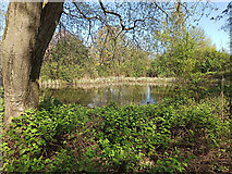
Richmond park
The model yacht pond, with the model boathouse in the distance.
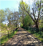
Richmond Park
A shady path at the south side of the ponds.
Richmond Park
The south end of the model yacht pond is a haven for birds.
Richmond Park
The south end of the model yacht pond is a haven for birds.
Richmond Park
April blossoms at the south end of the model yacht pond.
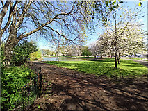
Richmond Park
Looking north over the model yacht pond.
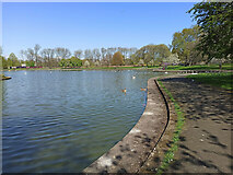
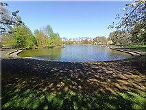
Richmond Park
The south end of the model yacht pond.
Richmond Park
Blossom trees at the south end of the model yacht pond.
New sculpture at Oatlands
Near the junction of Rutherglen Road and New Rutherglen Road at Shawfield Stadium.... more
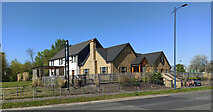
New apartment buildings, Oatlands
At Richmond Park Terrace.
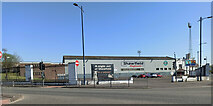
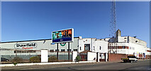
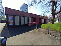
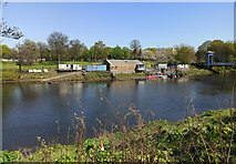
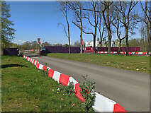
Shawfield Greyhound Stadium
Former home of Clyde FC, now a just greyhound stadium, having previously hosted... more
The Jenny Burn public house
At Richmond Park, opposite Shawfield Stadium.
Shawfield Greyhound Stadium
Former home of Clyde FC at the junction of Rutherglen Road and New Rutherglen Road.

Shawfield Greyhound Stadium
Sadly in a dilapidated state and temporarily closed as a result of the Covid-19... more
Shawfield Greyhound Stadium
The Rutherglen Road side of the stadium.
Shawfield Greyhound Stadium
The Rutherglen Road side of the stadium.
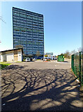
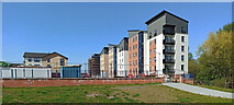
Red Tree at Magenta
Red Tree offers business accommodation under the Clyde Gateway regeneration... more
Red Tree at Magenta
Red Tree offers business accommodation under the Clyde Gateway regeneration... more
Red Tree at magenta
Red Tree offers business accommodation under the Clyde Gateway regeneration... more
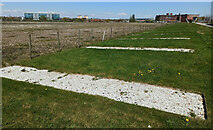
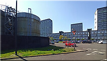
Clyde Gateway development land
Brownfield site with Police Scotland on the left, Celtic park in the distance... more
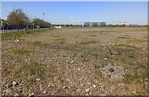
Clyde Gateway development land
Brownfield site with Police Scotland in the distance and one of the Shawfield... more
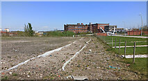
Clyde Gateway development land
Looking towards the former Strathclyde School and Shawfield Smartbridge over the... more
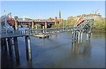
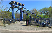
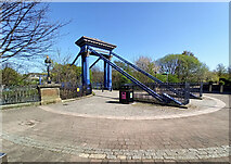
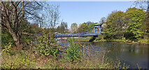
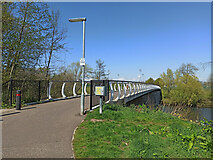
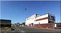
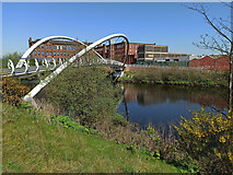
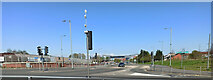
Shawfield Smartbridge
Looking from the south.
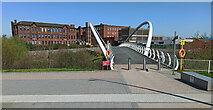
Shawfield Smartbridge
Looking from the south bank.
Shawfield Smartbridge
Looking downstream from the south bank.
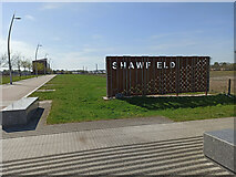
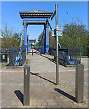
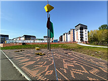
Shawfield gateway sign
At the south end of the Shawfield Smartbridge Continuing the current trend for... more
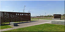
Shawfield gateway signs
At the south end of the Shawfield Smartbridge.
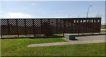
Shawfield gateway sign
At the south end of the Shawfield Smartbridge.
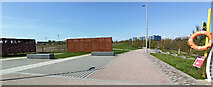
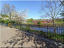
Riverside path
On the south bank of the Clyde, between Shawfield Smartbridge and Rutherglen Bridge.
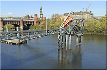
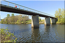
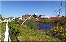
Shawfield Smartbridge
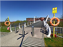
Shawfield Smartbridge
Looking along the bridge from the south side.
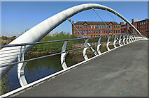
Shawfield Smartbridge
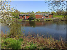
Looking through the arc on the downstream side of the bridge, with the former... more
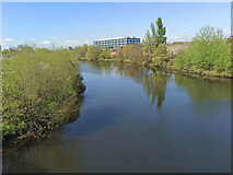
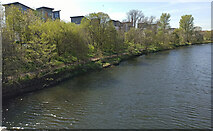
The River Clyde in Glasgow
Looking downstream from the Shawfield Smartbridge.

Police Scotland building
Looking downstream from the Shawfield Smartbridge.
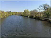
The River Clyde in Glasgow
Looking upstream from the Shawfield Smartbridge.
The River Clyde in Glasgow
Looking upstream from the Shawfield Smartbridge.
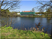
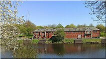
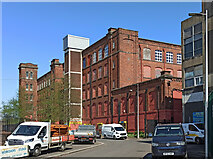
Old buildings at Dalmarnock
On the north bank of the Clyde at Shawfield Smartbridge. The former Strathclyde... more
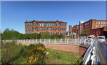
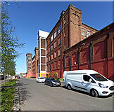
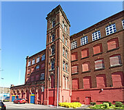
Former Glasgow Cotton Spinning Co mill
A Category B Listed building... more
Former Glasgow Cotton Spinning Co mill
A Category B Listed building... more
Former Glasgow Cotton Spinning Co mill
A Category B Listed building... more
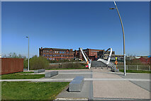
Clovend Street
Looking towards the Police Scotland building from Carstairs Street.
Greenway to Dalmarnock railway station
The north end of the path, near the station.
Greenway to Dalmarnock railway station
The bike hire point at the north end of the path, with Celtic Park stadium in the... more
Dalmarnock Railway Station
Looking across the recently formed hammerhead turning point at Swanston Street.
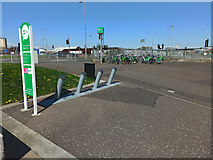
e-bike hire station at Dalmarnock Railway station
Electric cycle hire provided by OVO Bikes at Dalmarnock station.
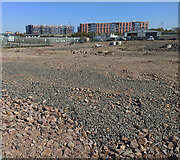
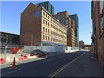
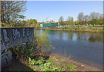
Brownfield site at Dalmarnock
Looking from Carstairs Street, across the site of Bonnar Street to Swanston Street... more
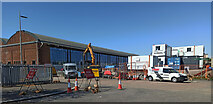
Former gasworks buildings at Dalmarnock
Creative workspaces, offices and studios being created in the former purifier shed... more
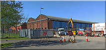
Former gasworks buildings at Dalmarnock
Creative workspaces, offices and studios being created in the former purifier shed... more
Clyde Gateway
Looking from Dalmarnock railway station to the 1Km distant Celtic Park stadium.
Dalmarnock Road at Old Dalmarnock Road
The older road is to the left.
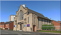
Former Bridgeton Free Church
A Category B Listed building... more
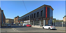
Dalmarnock Road
The Red Tree business centre is prominent amongst the older buildings.
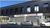
Church and chippy on Dalmarnock Road
At the Red Tree business centre.
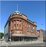
Olympia at Bridgeton
The auditorium was demolished in 2011, but the red sandstone part of the building... more
All images © Thomas Nugent and available under a
Creative Commons licence  .
.