2008
SK1903 : Birmingham and Fazeley Canal north of Bonehill, Staffordshire
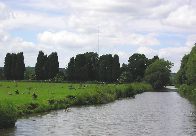
taken 16 years ago, near to Bonehill, Staffordshire, England
This is 1 of 3 images, with title Birmingham and Fazeley Canal north of Bonehill, Staffordshire in this square
Birmingham and Fazeley Canal north of Bonehill, Staffordshire
This is about halfway between Fazeley Junction and Hopwas. The Lichfield Transmission Mast (1001 feet high, 305 metres) is about three km away. In 2010 it transmitted only TV (Channel) Five (analogue) and a few radio channels.
Canada Geese are grazing in the field. It is a pity that such beautiful and friendly birds are having to be culled.
The Coventry Canal was started in 1768, and reached Atherstone by 1771, but lack of money meant that although it was planned to end at Fradley Junction, it had still only reached Fazeley by 1790. In the meantime, the Birmingham and Fazeley Canal had been built and used the Coventry Canal's original planned line to Whittington Brook, including the section shown in this and nearby pictures.
A further section beyond that (to Fradley) was built by another company, then subsequently purchased by the Coventry company. Consequently this five and a half mile section of the Birmingham and Fazeley Canal (with un-numbered bridges) splits the Coventry Canal (with numbered bridges). Confused?
Update: Hopwas Mast, or more correctly the Lichfield transmitting station replaced an earlier structure in 1961 and ceased transmissions at the end of the analogue era in 2011. Link
 Map © Crown Copyright")
TIP: Click the map for more Large scale mapping
- Grid Square
- SK1903, 134 images (more nearby 🔍)
- Photographer
- Roger D Kidd (more nearby)
- Date Taken
- Wednesday, 11 June, 2008 (more nearby)
- Submitted
- Monday, 13 October, 2008
- Subject Location
-
OSGB36:
 SK 192 032 [100m precision]
WGS84: 52:37.6004N 1:43.0672W - Camera Location
-
OSGB36: SK 193 032
- View Direction
- WEST (about 270 degrees)