2008
TG2310 : Maurice Raes Close
taken 16 years ago, near to Norwich, Norfolk, England
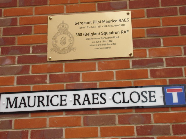
Maurice Raes Close.
A (2007-08) housing development named after the Belgian pilot of that name whose aircraft crashed there in World War 2.
 Map © Crown Copyright")
TIP: Click the map for more Large scale mapping
- Grid Square
- TG2310, 42 images (more nearby 🔍)
- Photographer
- Ian Bostle (more nearby)
- Date Taken
- Thursday, 24 April, 2008 (more nearby)
- Submitted
- Sunday, 16 November, 2008
- Subject Location
-
OSGB36:
 TG 233 102 [100m precision]
WGS84: 52:38.6379N 1:18.0329E - Camera Location
-
OSGB36: TG 234 101
- View Direction
- North-northwest (about 337 degrees)