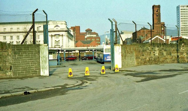
J3474 : Former Oxford Street bus station, Belfast
taken 31 years ago, near to Belfast, Co Antrim, Northern Ireland

A disused sewage pumping station on the eastern side of Oxford Street, advertised and agreed for sale towards the end of 2016. Described by the selling agents as “The subject is Oxford Street Pumping Station, a redundant Northern Ireland Water Building which occupies a highly prominent location in Belfast City Centre. Internally the ground floor of the building comprises an open mesh floor on steel frame around the perimeter with painted brick walls. There is a drywell at basement level which is now drained of water while there is a concrete mezzanine area at the rear of the building. The site occupies a highly prominent location sitting immediately to the front of the Waterfront Hall with frontage to Oxford Street, which is one of the principal arterial routes in Belfast City Centre.”
Northern Ireland Water is reported as follows "The site was built as a storm water pumping station in the 1930s by the then Belfast Corporation. Along with three other similar facilities elsewhere in the city, it has been out of service since late 2009, when the Belfast Storm Water Tunnel was commissioned."
The 1951 street directory shows “10-14. Cairnes Ltd., Brewers, Drogheda (stores) Preston Bros., & Co., (Cairnes Ltd.), Wholesale Wine and Spirit Merchants. 16. Pumping Station 18. Entrance to Cattle Market 20-32. Wall”. The station was the last remaining pre-Laganside building remaining on the street’s eastern side.
It does not appear (at 13 December 2016) to be listed.
There is the following application (6 March 2019) for planning permission “LA04/2019/0657/F Change of use from water pumping station to restaurant & café including external alterations & new 2 storey extension. 16 Oxford Street Belfast BT1 3WH”.
- Grid Square
- J3474, 4349 images (more nearby
 )
)
- Photographer
- Albert Bridge (find more nearby)
- Date Taken
- Tuesday, 11 May, 1993 (more nearby)
- Submitted
- Tuesday, 18 November, 2008
- Category
- Urban regeneration (more nearby)
- Subject Location
-
Irish:
 J 344 741 [100m precision]
WGS84: 54:35.8619N 5:55.2369W - Camera Location
-
Irish:
 J 345 741
 - View Direction
- WEST (about 270 degrees)
![Creative Commons Licence [Some Rights Reserved]](https://s1.geograph.org.uk/img/somerights20.gif)
