C7500 : Moneyneaney, Draperstown. "The Turf Road"
taken 16 years ago, 3 km from Moneyneany, Co Londonderry, Northern Ireland
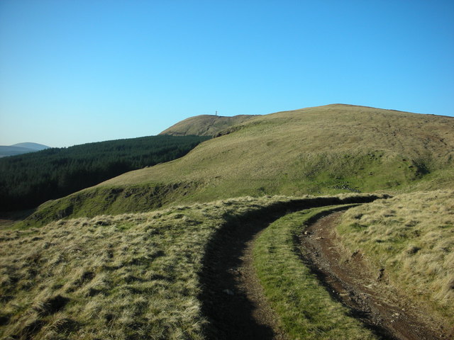
Moneyneaney, Draperstown. "The Turf Road"
From this road, to the left you can see, "Eagle's Rock" (Craig-Na-Shoke) Moydamlaght forest, and in the distance Mullaghmore mountain with the communications mast on the summit. By following this path in the opposite direction it will take you to the summit of Bohilbreaga mountain (Lying Boy) with an elevation of 478 metres. (1568 feet) Photo taken at Map Ref. C75104 00211 Elevation 429 metres (1408 feet)
![Creative Commons Licence [Some Rights Reserved]](https://s1.geograph.org.uk/img/somerights20.gif)
|
· Find out How to reuse this image ·
Share:
|
|||||
| Start a discussion on C7500 | Suggest an update to this image | Contact the contributor | |||
Loading map... (JavaScript required)
- Grid Square
- C7500 (more nearby
 )
)
- Photographer
- Michael Murtagh (find more nearby)
- Date Taken
- Wednesday, 13 February, 2008 (more nearby)
- Submitted
- Thursday, 20 November, 2008
- Category
- Path > Path (more nearby)
- Subject Location
-
Irish:
 C 75104 00211 [1m precision]
WGS84: 54:50.6427N 6:49.9012W - Camera Location
-
Irish: C 75104 00211
- View Direction
- North-northwest (about 337 degrees)
This page has been viewed about 191 times.
View this location:
KML (Google Earth) ·
Google Maps ·
Bing Maps ·
Geograph Coverage Map ·
More Links for this image
·
Bing Maps ·
Geograph Coverage Map ·
More Links for this image