M2208 : Ballyvaughan Harbour
taken 15 years ago, near to Ballyvaghan, Co Clare, Ireland
This is 1 of 4 images, with title Ballyvaughan Harbour in this square
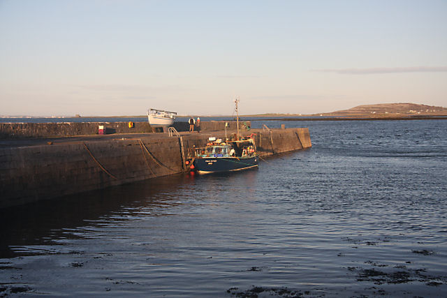
Ballyvaughan Harbour
This old harbour has been supplemented by another pier, constructed in deeper water 300m to the east. However, it is still used by the occasional fishing vessel.
![Creative Commons Licence [Some Rights Reserved]](https://s1.geograph.org.uk/img/somerights20.gif)
|
· Find out How to reuse this image ·
Share:
|
|||||
| Start a discussion on M2208 | Suggest an update to this image | Contact the contributor | |||
Loading map... (JavaScript required)
- Grid Square
- M2208, 85 images (more nearby
 )
)
- Photographer
- Bob Jones (find more nearby)
- Date Taken
- Sunday, 14 December, 2008 (more nearby)
- Submitted
- Tuesday, 23 December, 2008
- Category
- Harbour (more nearby)
- Subject Location
-
Irish:
 M 228 083 [100m precision]
WGS84: 53:7.2082N 9:9.1744W - Camera Location
-
Irish: M 228 082
- View Direction
- NORTH (about 0 degrees)
Image classification(about):
Geograph (Third Visitor for M2208)
This page has been viewed about 53 times.
View this location:
KML (Google Earth) ·
Google Maps ·
Bing Maps ·
Geograph Coverage Map ·
More Links for this image
·
Bing Maps ·
Geograph Coverage Map ·
More Links for this image